We miss all of our family and friends in Jackson, Miss., but Portland's home now.
Friday, December 30, 2011
Portland Trail Blazers, 3-0. OK, we've got 63 more games to play until the play-offs begin. But I'm a happy season-ticket-holder!
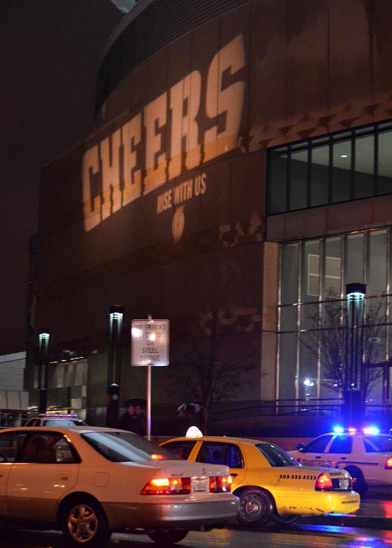
Thursday night after the game I waited for the 70 bus across the street from the Rose Garden Arena. First time I noticed this light-show-sort-of-sign on the building. Cheers! That's what we'd been doing inside that great big building!
By the way, those two police cars and their officers are always outside the arena, before and after the games. I think it's a good idea in a crowd of around 20,000, some of whom have been drinking beer for several hours, to have them visible; most of the 20,000 had already made their way far from the building. The flashing light bars help folks find their way once they've exited the arena--people like me because I'm still learning my way around the place.
Labels:
cheers,
crowd,
Portland Trail Blazers,
Rose Garden Arena
Thursday, December 29, 2011
The story of two photos, pure amazement and serendipity for me!
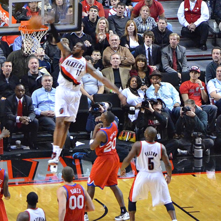
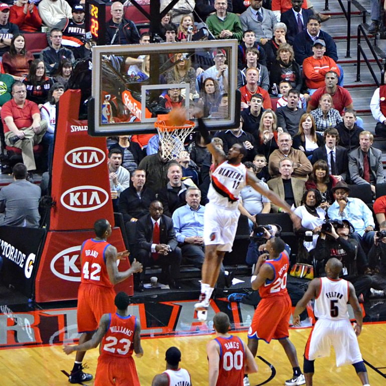
Monday night, December 26, the Trail Blazers played Philadelphia in our season opener. Fans and those whose employment depend upon the games taking place, as well as the players and coaches, feel pretty good about basketball being back in Portland.
Lots of Trail Blazer fans count #12, LaMarcus Aldridge, as their favorite player.
One of the photos in this short, short story is this one that I took from clean across the entire arena of LaMarcus Aldridge as he scored. Totally excited to get it!
When I decided to post the photo, I searched on Google for trail blazers philadelphia december 26, 2011. And I come across photos from the game taken by the Oregonian, Portland's daily newspaper. Lo and behold, the very first photo I saw is of the same instant of action, taken by the photographer (Bruce Ely) sitting on the floor at the baseline--you can barely see him on the right edge of my photo because I cropped close to LaMarcus and the basket. (More about that at the bottom of the post.)
If you click on the link, you'll see the second photo in this short, short story. And be amazed.
To tell you the truth, I did the search hoping to find the photo and a word or two about who had passed the ball to LaMarcus and if this was one of those lob passes like I'm pretty sure I remember it was. Anyway, the caption beneath Ely's photo was no help, but I was very excited to see the action from his perspective, let me tell you! Please click on the link above or here to see Ely's photo. I would have tried to copy and paste it onto the blog, but I didn't feel that would be the right thing to do. One of these days maybe I'll contact him for permission, if this happens again!
Here I've I cropped the photo differently so you could see Bruce Ely. Look at that other camera and lens standing in front of him!
Wednesday, December 28, 2011
A scene you won't see in Portland today
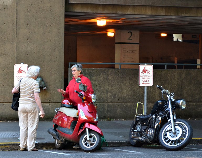
On a September Saturday, these two women stood talking on SW Broadway. The woman on the left had been to the PSU Farmers Market, filling her navy blue bag with untold fresh goodies. Maybe the woman on the right had been there, too, and had stored her goodies somewhere in the scooter. Can you guess the reason that scenes like this won't be repeated today? It's pouring rain and blowing, blowing, blowing wind. I can hear it hitting the windows of my apartment right now. And after work yesterday I had to hold my hood shut, or it would have blown right off my head! On my way to the basketball game and hours later after the game!
Here's what KGW Channel 8's meteorologist Nick Allard has to say about the weather online: This morning it is mild, wet, breezy and will be all day. Another round of heavy rain is moving in to the area and later today it will be really wet again. The winds are staying pretty active this morning and also will for the rest of the day. There is a High Wind Warning in effect for the central Oregon Coast until this evening. Winds will be sustained between 30-40 mph with gusts that may approach 50-70 mph especially right at the coast line. The rest of the area will be breezy at times with moderate to heavy rain. In fact anywhere from half an inch to an inch is possible all over the place. Highs will top out in the mid-50s. The snow level will stay high today in the 7-8,000' range.
Tomorrow another round of rain will push in, but the heaviest rain will stay south of our area. So overall the rain will be much lighter. However into Friday another wet and breezy system will move in for rain during the day and some decent mountain snow by Friday night.
Tuesday, December 27, 2011
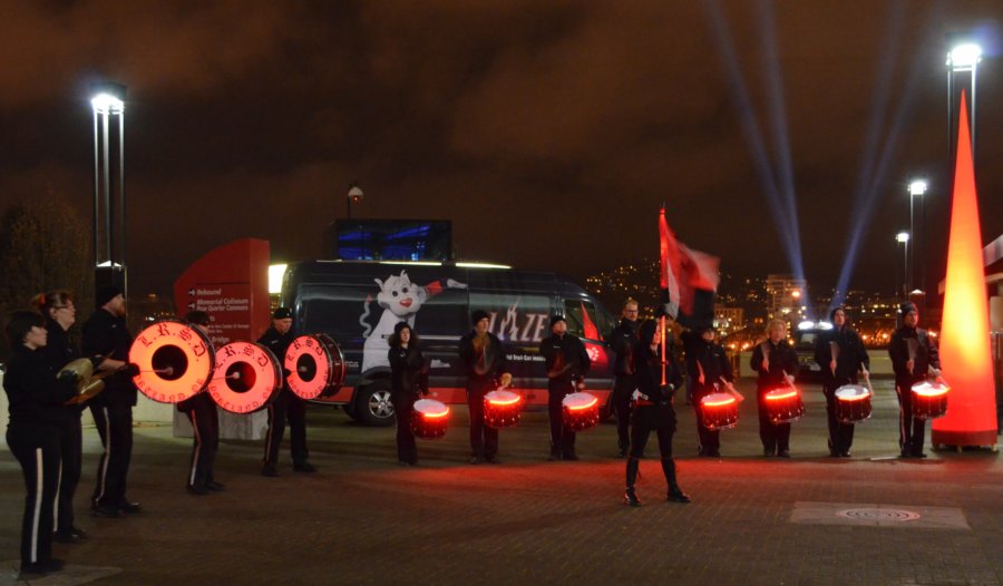
Last Regiment of Syncopated Drummers Outside the Rose Garden Arena
I got off the bus to walk to the STH door at the Rose Garden Arena on Monday night and heard drumming. I love drumming. And the Last Regiment of Syncopated Drummers can really drum! Even in the cold.
Monday, December 26, 2011
Curves, similar shapes, dissimiliar substances
Today's title refers to the brim of the top hat and the curve of bell on the CG Conn Grand Jumbo 46K Sousaphone. I suppose the top hat is made of wool felt. And the tuba is made of silver-colored sheet brass. I know, I know. You thought I was going to point out that it refers to the top of the head and the curve of the bell on the golden CG Conn 20K. A toss up, which one to mention first!
I got the name of the tuba from two commenters on a previous post, one named Anonymous, one named Ian. Turns out that Ian is playing the CG Conn Grand Jumbo 46K Sousaphone! And Anonymous, actually Fred Williams is his name according to Ian, was playing a CG Conn 20K in the other post, standing between the two tubas you see here but facing towards them-- the one Ian is playing and to the golden one played by Johnny Quirarte of Los Culpables de la Sierra, according to Ian who is a veritable fount of information. Thanks, Ian!
Sunday, December 25, 2011
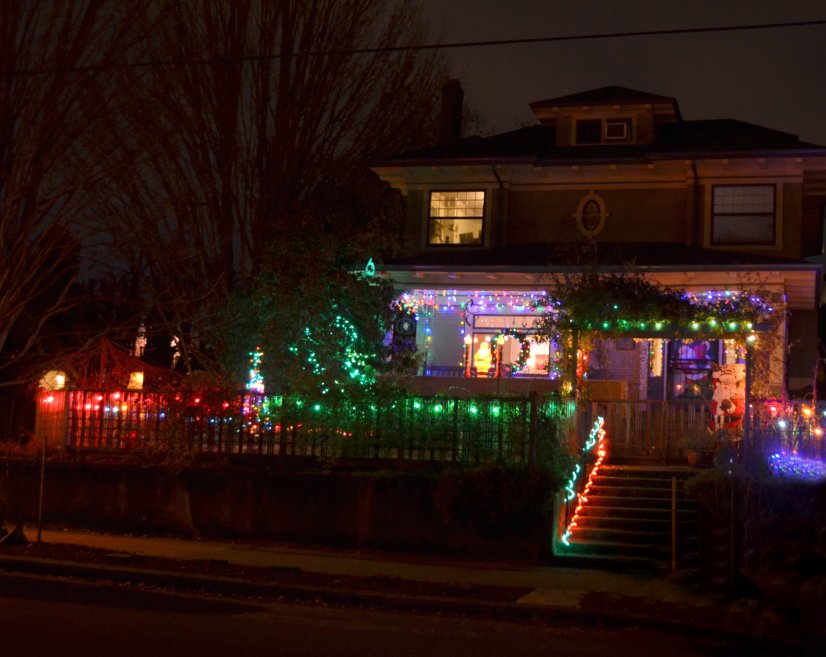
Look what I found in my neighborhood.
I'm of two minds about Christmas lights. First, I'm always happy to see them because they are so beautiful. Second, I'm always happy that putting them up and taking them down is someone else's chore because it's a tremendous amount of work.
When my husband was alive, we decorated our tree and around the living room windows. After he died and my sons were still little boys, I decorated the tree and around the windows. Several years after my Daddy died, I moved back in with my Mama (widows together enjoying the life left to us), and we decorated several different trees over the years and around our windows. My sons are out on their own, decorating as their lives lead them. Now I'm on my own, too. I have a little Department 56 tree, the sweetest item I've ever been fortunate enough to purchase at Goodwill, and a string of lights glowing on the cabinet top around it. Merry Christmas decorating, ol' 64-year-old-me style.
Saturday, December 24, 2011
Merry. Christmas. Y'all!
I like what's going on in this photo so much that I had to divide it into three pieces so that you could have fun seeing it all, too. And then it's put together again at the bottom of the post.
Merry.
Christmas.
Y'all.
Merry Christmas, Y'all! Took this photo in the northeast corner of Pioneer Courthouse Square as the tubas warmed up to my right, getting ready for Christmas carols and Tuba Christmas, December 10, 2011.
Merry.
Christmas.
Y'all.
Merry Christmas, Y'all! Took this photo in the northeast corner of Pioneer Courthouse Square as the tubas warmed up to my right, getting ready for Christmas carols and Tuba Christmas, December 10, 2011.
Friday, December 23, 2011
This duo got the stamp of approval from everyone at Tuba Christmas, ...
... well, everyone who had the opportunity to see the Gingerbread (Wo)Man and the Christmas Tree and get a candy cane from the basket. I imagine the two of them were quite happy to be encased in decorative costumes, as long as they had on some longhandles to keep them warm. You can tell from the children's winter wear, as well as everyone else in the crowd behind the holiday duo, just how cold it was on Saturday, December 10, in downtown Portland at Pioneer Courthouse Square.
Thursday, December 22, 2011
It's all in how you look at it.
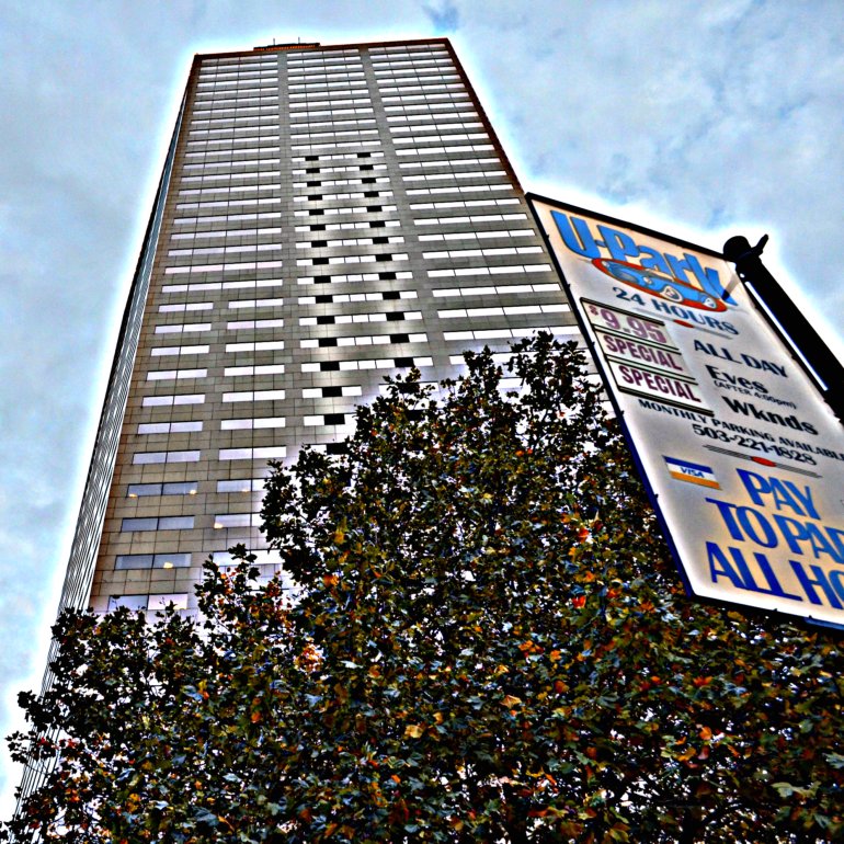
Big Pink and a parking lot sign. The sign is on the southeast corner of SW Broadway and West Burnside. Big Pink is exactly one block east of the sign. I used the tilt feature of my camera so that I could take a satisfactory look from this unusual angle. I've cropped the photo and used the HDR-ish special effect at Picnik. By the way, Big Pink is either 536 or 546 feet tall and is the second tallest building in Portland. I found both heights on the Internet, so who knows. I do know I've been on the 30th floor, which is not the top floor, to the Portland City Grill. See views from the PCG here and here.
Labels:
Big Pink,
HDR-ish,
Picnik,
Portland City Grill,
SW Broadway,
West Burnside
Wednesday, December 21, 2011
Random pedestrians, downtown Portland
I took this photo after work on November 3 as I waited for the 12 or the 19 bus home. I'd been to have a check up on the floaters in my right eye, rode the Yellow Line MAX to Kaiser Interstate and then back downtown to the Transit Mall so I could transfer to a bus. I like watching folks walk across SW 6th Avenue while I wait. They are heading north towards the intersection with SW Yamhill which is the south side of Pioneer Courthouse Square. I'm very pleased with how this photo turned out. All I've done is crop it to better showcase these two random pedestrians, or should I say three since the man's reflection is so clear in the window? The big X is inside a branch of Chase Bank. Oh, and the floaters in my eye have diminished--hooray!
Tuesday, December 20, 2011
Up, with Nolan Smith, Portland Trail Blazers Rookie
I'm as up in the air as rookie guard Nolan Smith is here. Portland Trail Blazers defeated the Utah Jazz 110-90.
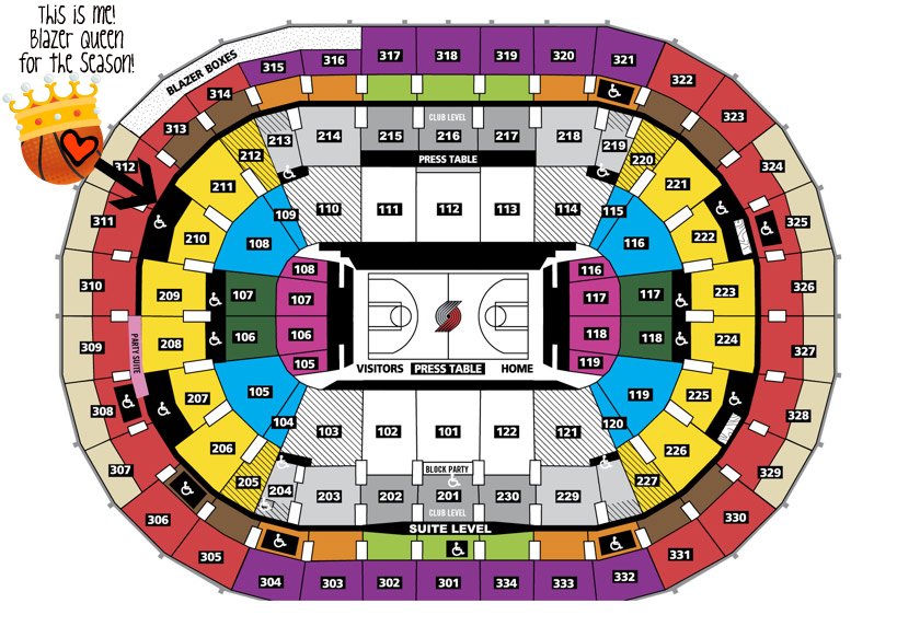
You can see what a great seat I have for this season! No one can stand or walk in front of me because I am on the front row of the highest ring around the arena!
On the sports just now, I saw the replay of the shot that Nolan took--he scored!
Monday, December 19, 2011
The wait is over!
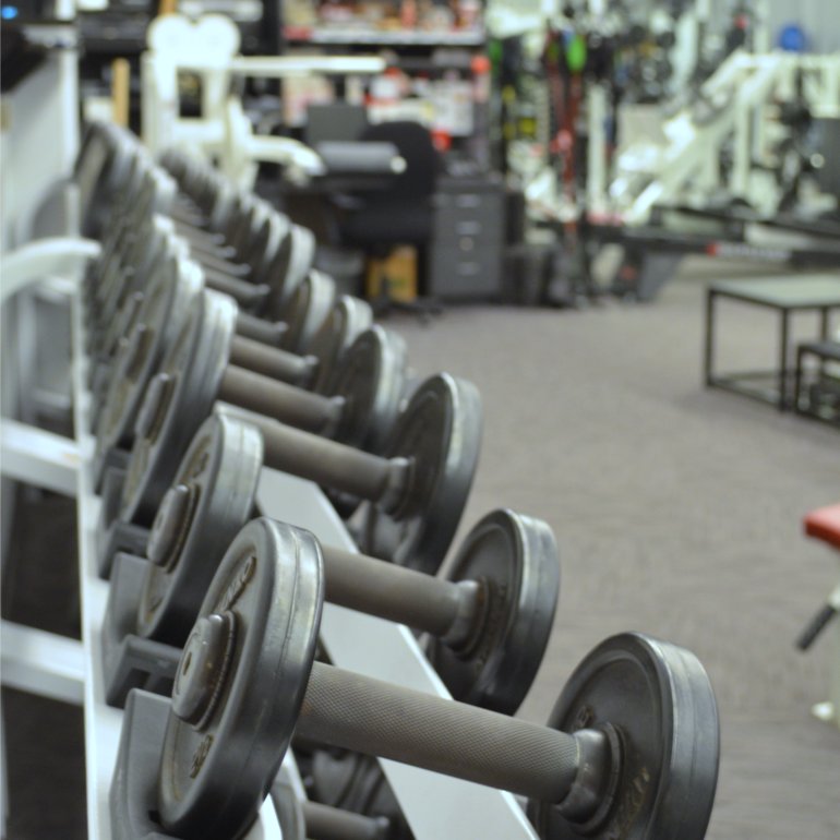
Yep, this photo of a rack weights in the Trail Blazers work out room fits just fine with my announcement at the top of this post. The wait is over! Our one-and-only-home-preseason-game takes place at 7 p.m. Monday in the Rose Garden Arena. The opposing team is the Utah Jazz. The home team is the Portland Trail Blazers! Go, Blazers! The best fans in the NBA will be in the house!
Labels:
Portland Trail Blazers,
Rose Garden Arena,
weights
Friday, December 16, 2011
In my neighborhood, at ReRack
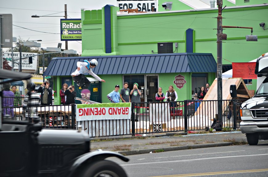
Sunday, October 16, on our way back after a trip to Freddie's for groceries, Lamont and I noticed something going on at ReRack, a nearby business. Couple hours later I went for a walk and figured it out. They'd shoveled snow onto hay, added a couple of ramps and adventurous snowboarders complete with fans. I especially like this photo because so much is going on. There's the 1920s automobile comes into view on the left, the snowboarder just left of center slides on the rail--his board is purple and white, three people take photos and/or videos, and others just watch as they face the action. The two people on the left with their backs to me wait in line to climb up onto the ramp out of view to the left so that they can take their turn. And see what looks like a speaker on the right, near the front of that van? Loud music, but not obnoxiously so. Looks like at least one watcher arrived on a bicycle--I believe I see a basket and a brake. Some may have arrived on TriMet--there's a bus shelter in the background to the left of the guy in the olive green cap taking a photo with his phone. The green and blue building is not for sale, to my knowledge. There's an empty lot just beyond it with that giant sign standing near the street, sort of a parking area I think. At ReRack's Facebook page, there are lots of splendid photos in an album called Rad Ruckus Rail Jam 2011, taken by GEE-Photo.
Labels:
neighborhood,
Rad Ruckus Rail Jam 2011,
ReRack,
snowboarding
Thursday, December 15, 2011
A cute, but cold, Tuba Christmas fan
Look at her pink nose. The cold made it match the color of her jacket and hat perfectly. Cropped and altered at Picnik.
Labels:
cold,
little girl,
Pioneer Courthouse Square,
Tuba Christmas
Wednesday, December 14, 2011
Lownsdale Square, oh to able to stand in the park again
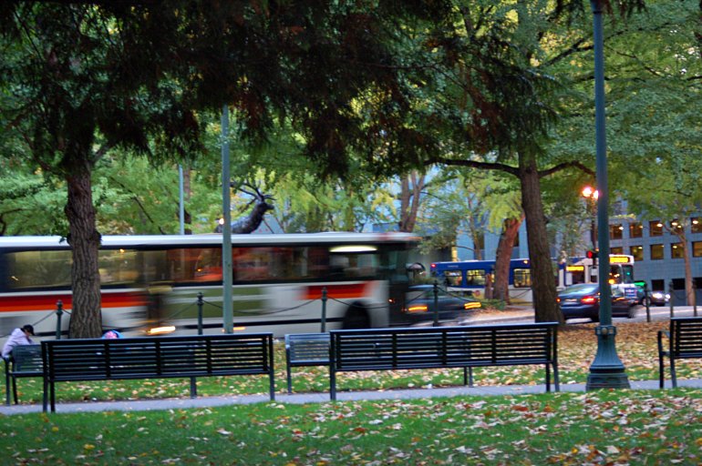
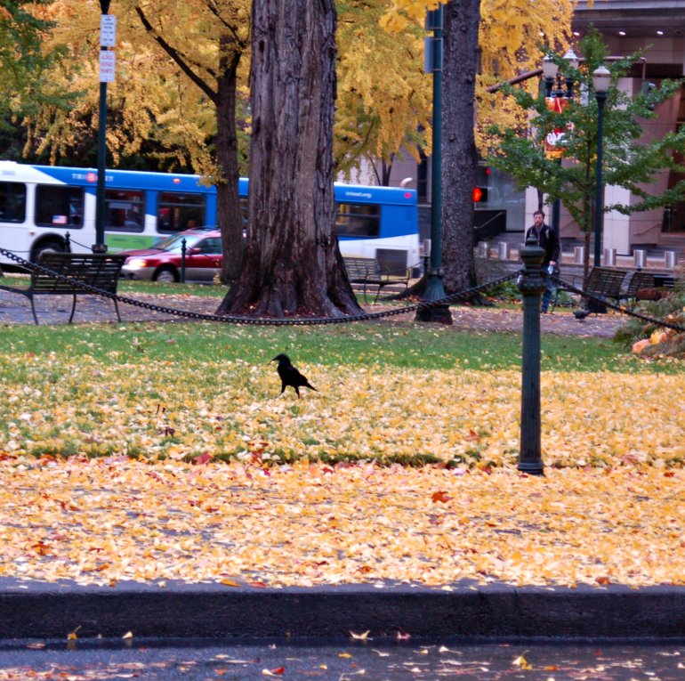
This photo was taken Oct. 16, 2007, as I stood in Lownsdale Square, looking south towards the Thompson Elk and Chapman Square. The TriMet bus heading west on SW Main hides the elk's legs as it makes the curve around the statue's base. You can tell how the ground rises as you walk west through the park. Today on the bus before and after work, I saw the fences around both parks. The only evidence I noticed of any restoration progress was the complete absence of lots of park benches. The original estimate I read in the Oregonian and posted on here on December 3 mentioned "Replace two park benches, repair seven benches: $16,500." It was not mentioned which park or if these benches were spread between both parks. The missing benches I noticed were all in Chapman Square. The bus stopped at the intersection is on SW 4th Avenue. At the time that this photo was taken, the downtown Transit Mall had been moved to SW 3rd and SW 4th while SW 5th and SW 6th underwent extensive renovation, part of which was the addition of the MAX Green Line.
Labels:
Chapman Square,
Lownsdale Square,
Thompson Elk,
TriMet
Tuesday, December 13, 2011
Tuba Christmas, Pioneer Courthouse Square, December 10, 2011
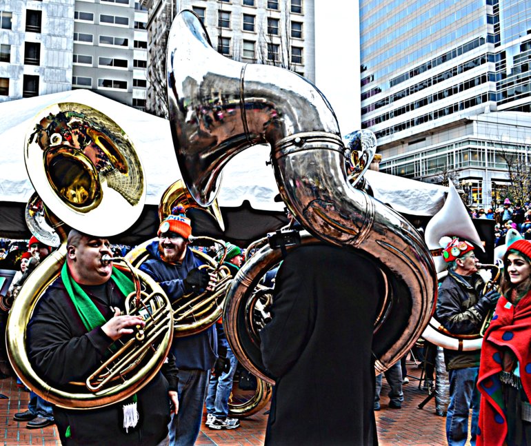
I arrived on scene about 10 minutes before Tuba Christmas began, all 225 tubas would play to a standing room only crowd, one Christmas carol after another. Realizing I would not find anywhere to sit and that I wouldn't care because it was so doggone cold, I walked close to these two bass tubas--is that what you call these humongous instruments? Aren't they heavy? I don't know. But I do know that the man on the left played a beat on his tuba that had everyone getting their groove on. Then the man on the right and he challenged each other, vibrating the air around us magnificently, bringing smiles to nearby faces.
Monday, December 12, 2011
It's my birthday today. A present to myself!
Sunday, December 11, 2011, found me at my first event as a Portland Trail Blazers' season ticket holder. Holiday on Ice lasted from 2-5 p.m. I stayed almost the entire time, first going on the locker room tour, then wandering around on the concourse, decorating cookies, making crafts. I talked with the radio announcer, nicknamed Wheels, and one of the TV announcers, Mike Barrett. I met Scott, my Season Ticket Services Account Representative. By 3 p.m. Blazers were walking here and walking there, smiling at all of us, stopping for photographs or autographs as time allowed. I took lots of photos and talked to about half of the team, getting a few autographs.
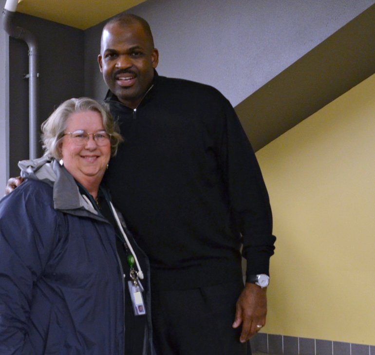
Next I decided to go back to the locker room to see in any others were there. Lo and behold, there stood Coach Nate McMillan. I moved down the line from player to player and then I was in front of him. I couldn't help myself, when I started to talk, saying "I can't believe I'm standing in front of you. My Mama would be so excited. She became a basketball fan after we moved here in 2006 ... I'm sorry, I'm crying. She died in January."
I can't remember exactly what happened after that, somewhere in there I explained that I was a first-time season ticket holder. I know I felt good when Coach McMillan signed my piece of paper and took me seriously when I handed to him the PTB lanyard I had purchased in the Fan Shop, rubbing it for good luck over and over because I explained that I was going from player to player, collecting good luck for the team ever since I bought it and Gerald Wallace touched it first before putting it into the shopping bag. Coach handed me the lanyard, we shook hands and smiled at each other as I told him what a good time I was having here. Coach McMillan smiled some more when I looked to his right and said, "That's Buck Williams, right there." I patted my heart and sort of swooned. Coach Williams grinned and said, "I wish my wife could see some of this around here." The three of us laughed together for a moment. I might not be able to remember every single thing that happened, but I will always remember standing there in front of those gracious, tall men.
I rode the elevator up with them and several players. Then on the concourse Coach McMillan sat down by himself at the coloring table, waiting for folks to come see him. I sat down in front of him and he asked me what was Mama's health problem, so we talked for a few minutes about what had gone on with her health and what had happened to her on January 7. I even explained that I hoped she had just left her phone in the bedroom and was sitting in front of the TV watching the Blazers play and couldn't hear her phone. Instead she had laid down for a nap and didn't wake up. He listened and smiled kindly. I went on to say that Mama had been so impressed with the kind of young men the Trail Blazers he was leading the players to be, individuals who care about themselves and the team and Portland. He said that's what he was trying to do and shook my hand again, saying he was glad I was a season ticket holder. I said that I was so happy about it because, while I didn't want to be one while I had Mama to watch games with at home, that I had missed basketball in person after having spent six years keeping score for the boys and girls' high school teams, both at the scorer's table for home games and on the bench for away games where i used to teach English and be a librarian down in Mississippi. He grinned. I stopped rambling. Then I got up so that someone else could spend some time with him.
Later on I sat talking with Scott my account rep and asked him if he would go with me and take a photo of me with the coach. By the time we got close to the front of the line, Coach and the players had to leave the coloring table and head somewhere else on the concourse. After I had walked around in the concourse for a while, it dawned on me that I might find Coach McMillan at a different table and maybe I could get someone to take the photo I wanted. You can see the result at the top of the post.
I am so looking forward to attending our home games. I'll be able to do that on mass transit, too!
Happy 64th birthday to me!
Labels:
Coach Nate McMillan,
Lynette,
Portland Trail Blazers
Sunday, December 11, 2011
Sunday Bridges: Hawthorne Bridge, the towers in the sunrise
See more Sunday Bridges at San Francisco Bay Daily Photo.
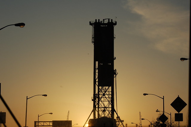
February 20, 2009, the sun provided a golden background for the Hawthorne Bridge towers. There really are two towers here--the large rectangles you see are the counterweights which, when lowered, raise the center section to the bridge. The higher one was closer to me when I took this photo. The Hawthorne Bridge is special to me for several reasons--it's the first bridge I road a bus over, in June, 2004, when we first visited my sons here; it's the first bridge I walked over, in January, 2007, through a thick snowstorm; it's the bridge I cross most often.
Here's what I found at Wikipedia: The Hawthorne Bridge is a truss bridge with a vertical lift that spans the Willamette River in Portland, Oregon, joining Hawthorne Boulevard and Madison Street. It is the oldest vertical-lift bridge in operation in the United States and the oldest highway bridge in Portland. It is also the busiest bicycle and transit bridge in Oregon, with over 4,800 cyclists and 800 TriMet buses (carrying about 17,400 riders) daily.
Size
The bridge consists of five fixed spans and one 244 ft (74 m) long vertical-lift span. It is 1,382 feet (421 m) in total length. The 880,000 pound (400,000 kg) counterweights are suspended from the two 165 ft (50 m) tall towers. While the river is at low level the bridge is 49 feet (15 m) above the water, causing it to be raised an average of 200 times per month. As of 2001, the average daily traffic was 30,500 vehicles. The bridge was designed by John Waddell, inventor of the vertical-lift bridge and also designer of the Steel and Interstate bridges.
History
The current bridge was built to replace Madison Bridge No. 1 (1891) and Madison Bridge No. 2 (1900), which was destroyed by a fire in 1902. It cost $511,000 to build and was opened on December 19, 1910. Hawthorne Boulevard (and thus the bridge) was named after Dr. J.C. Hawthorne, the cofounder of Oregon's first mental hospital and early proponent for the first Morrison Bridge.
The deck was changed from wood to steel grating in 1945. In 1985 the lift span sheaves, the grooved wheels that guide the counterweight cables, were replaced. The bridge went through a $22 million restoration from 1998–99, which included replacing the steel grated deck and repainting. The original lead-based paint was completely removed and replaced with 3 layers of new paint that is estimated to last 30 years. During this upgrade the sidewalks were widened to 10 feet (3 m), making it a thoroughfare for bicycle commuters. Due to the replacement of the steel deck during this project, the channels which used to carry the rails for streetcars and interurban trains were also removed. In 2001 the sidewalks were connected to the Eastbank Esplanade. The estimated cost to replace the bridge is $189.3 million.
The original color of the bridge was black, lasting until 1964, when it was repainted yellow ochre.[7] During the 1998-99 renovation, the color was changed to green with red trim.
The 2003 film, The Hunted, included a scene set on MAX on the Hawthorne Bridge. Since MAX does not cross the bridge, the movie company connected two articulated buses remodeled to resemble a MAX train, complete with fake overhead lines and a sprinkler system to simulate rain. Light-rail (interurban) service did cross the Hawthorne Bridge until 1956. The new deck put in place in the outer lanes during the 1998–99 renovation was designed to be strong enough for possible use by modern, heavier streetcars or light rail trains in the future, which was proposed at that time, and TriMet was still considering a Hawthorne Bridge routing for its future MAX Orange Line, to Milwaukie, in 2002. However, following the transit agency's later decision to build a new bridge for the Milwaukie MAX line, which bridge could also be used by the Portland Streetcar, it became unlikely that rail cars will ever again cross the Hawthorne Bridge.
Carries vehicles, pedestrians, cyclists
Crosses Willamette River
Locale Portland, Oregon
Maintained by Multnomah County
Design truss with a vertical-lift span
Total length 1,382 ft (421 m)
Width 72 ft (22 m)
Longest span 244 ft (74 m)
Clearance below 49 ft (15 m) closed, 159 ft (48 m) open
Opened December 19, 1910
Saturday, December 10, 2011
Chapman Square, two walkers in the park
Friday, December 09, 2011
Lownsdale Square, a couple of walkers
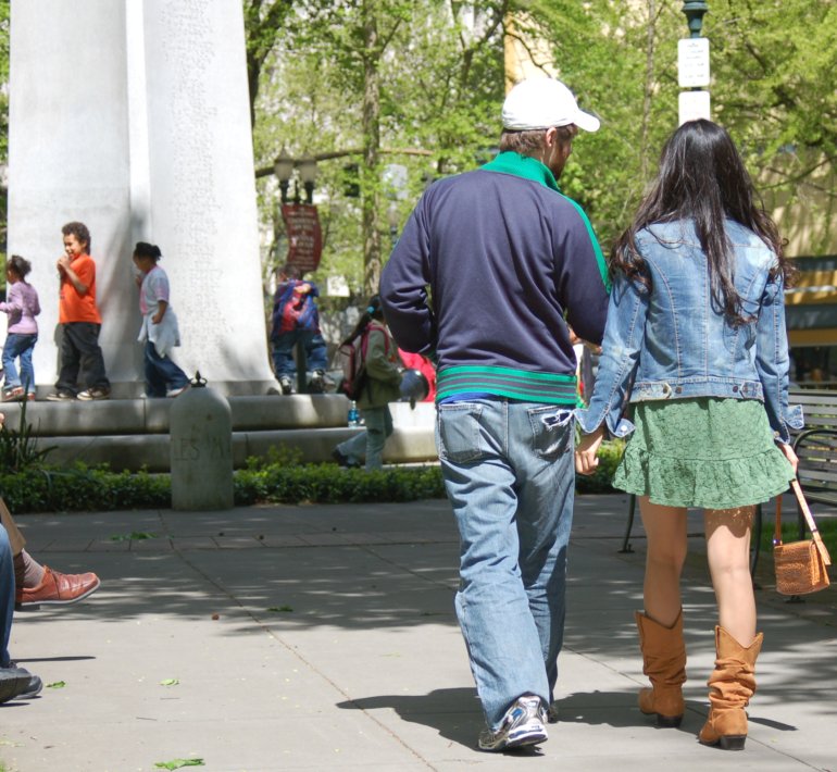
Enjoying the sunshine on May 1, 2009, a couple heads toward the center of Lownsdale Park. Children play on the base of the Soldiers' Monument, Douglas Tilden’s monument to the Oregonians killed in the Spanish-American War. Found on the Internet about the monument: "Dedicated on May 31, 1906, the tall granite obelisk is topped with a bronze replica of an infantryman of the Second Oregon U.S. Volunteer Infantry, part of the first large American fighting force ever sent overseas. At least two people sit side-by-side on a park bench in the sun. At the base of this monument are two small cannons from Fort Sumter (misspelled on the plaque) brought here by Colonel Henry E. Dosch. Because the cannons were used by both Union and Confederate troops, it was Dosch's idea to face one north and one south." You can see one of the black cannons beneath the left elbow of the man in the blue jacket.
At some point in 2012, various groups of people will once again enjoy the sunshine in Lownsdale Square.
Thursday, December 08, 2011
Chapman Square, photograph-taking in the sunshine
This group of children and two adults paused for a photo opportunity at the statue on the east side of Chapman Square on May 29, 2009. I know by next year, people will be able to enjoy good times like this in the park again.
Here's what I found out about the statue online:
In Chapman Square is a bronze statue commissioned by the Oregon Trail Coordinating Council to commemorate the 150th anniversary of the Oregon Trail in 1993. The Promised Land, by Oregon artist David Manuel, depicts a pioneer family - father, mother, and son - at the end of their journey. The red granite slab upon which the statue is mounted is inscribed with a quote by Thomas Jefferson. The plaza in front of the statue is sandblasted with footprints reminiscent of pre-settlement days: jackrabbit, black bear, porcupine, grouse, coyote, elk, and moccasin prints.
Labels:
bronze statue,
Chapman Square,
sunshine,
The Promised Land
Wednesday, December 07, 2011
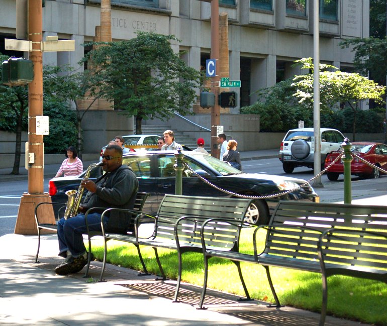
Lownsdale Square, downtown Portland, live saxophone
August 26, 2008, I heard this man playing his saxophone while I was in the park at lunch time. Such a pleasant experience, one that I want to enjoy again once the parks are restored. Those park benches are a whole lotta fun, too. Comfortable to sit on, and you can usually take your pick of sunshine or shade, on sunny days at least.
Labels:
downtown Portland,
Lownsdale Square,
man,
park bench,
saxophone,
sunshine
Tuesday, December 06, 2011
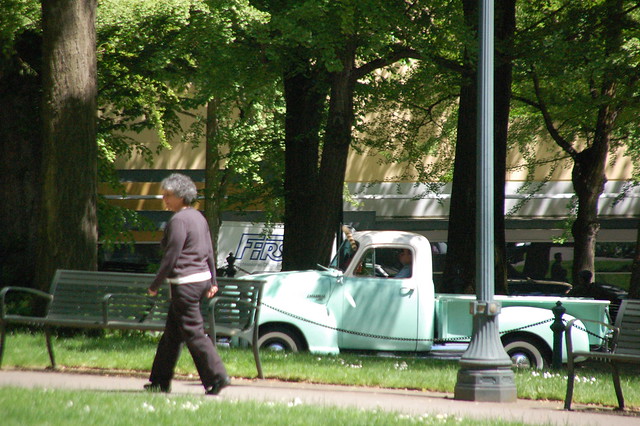
Chapman Square, lady walking in the sunshine, vintage pickup truck driving by
Took this photo during lunch hour, June 3, 2011. The lady is walking northwest towards the intersection of SW Main with SW 4th Avenue. The pickup truck is going west on SE Main, having just driven around the Thompson Elk which stands in the center of the street, between Lownsdale Square and Chapman Square. The white truck in the distance is going east on SW Salmon which is the street at the northern end of Lowndale Square. It looks to me like this lady is walking for exercise and/or enjoyment of the sunshine, two activities I believe we all hope that we shall enjoy again next June.
Labels:
Chapman Square,
lady,
sun,
Thompson Elk,
vintage pickup truck,
walking
Monday, December 05, 2011
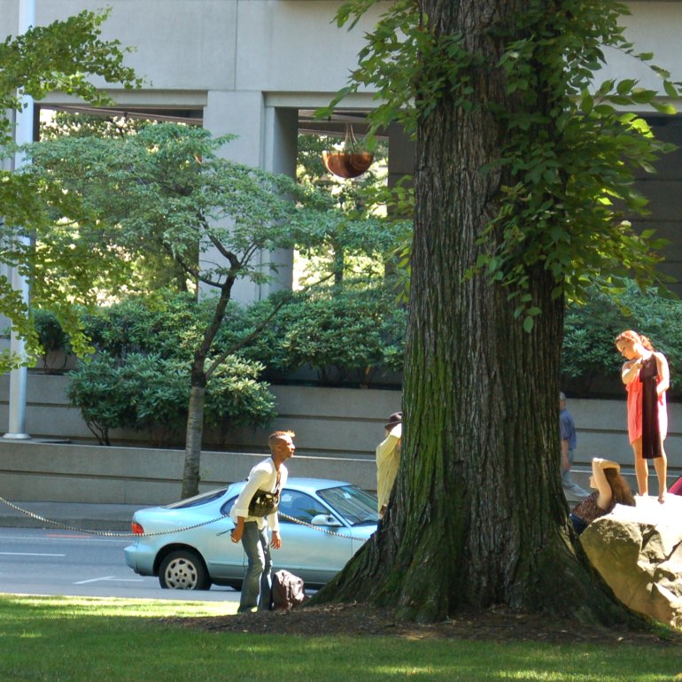
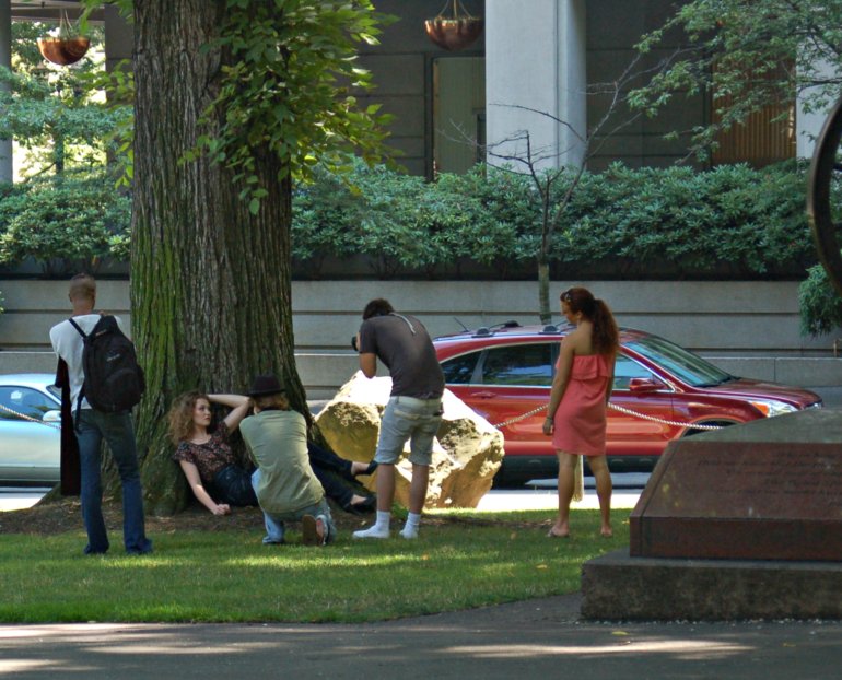
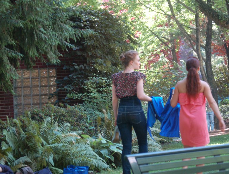
Chapman Square, photo shoot, July 27, 2009, taken during my lunch hour
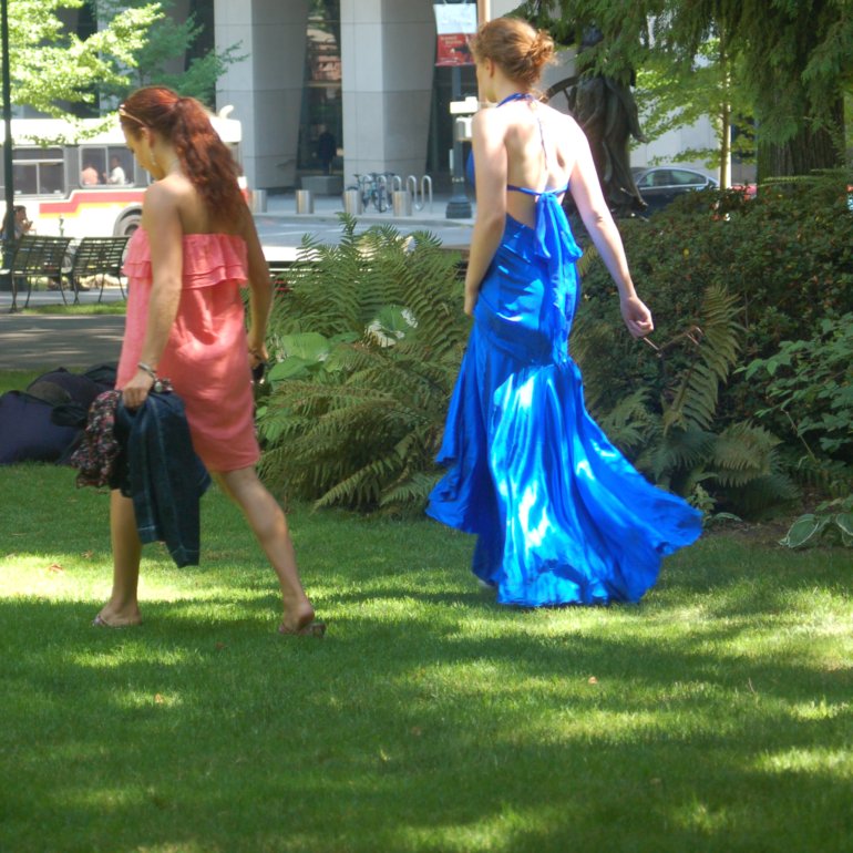
These photos give you an idea of one way people used Chapman Square and an idea of its grand trees, lush plantings and grass, all beautiful in the summer sun.
The woman standing on the boulder caught my eye. Immediately I notice the woman leaning on the boulder, and my eye continued to the left. Photo shoot, I surmised. The woman on the boulder appears to be holding a little black dress, used here to block incoming sunlight. The photographer stands to the left of the tree trunk, wearing a long-sleeved pale yellow shirt and a brimmed, black hat. I think the man farther left is the hair/make-up guy--I can see brushes and spray bottles and such in the pouched, black bag hanging across his chest.
Another shot on the other side of the tree trunk, which along with the boulder, stands inside the sidewalk on SW 3rd Avenue, on the eastern edge of Chapman Square.
A fresh-air closet on the sidewalk that diagonally intersects Chapman Square from SW 3rd and SW Madison to SW 4th and SW Main consisted of a rack of hanging garments, a hanging bag and a suitcase. Surely the woman on the bench was a member of the creative party, too; why else would the rack and the suitcase be so close to her?
The model and the dresser walk toward the Women's Restroom at Chapman Square. The glass block window is in its brick walls. I love those ferns you see along its walls. I don't know whose bags you see partially visible; no one else was nearby.
The last photo I took before I headed off to catch the bus back to work. They are headed off to take the next series of photos.
Labels:
Chapman Square,
downtown Portland,
photo shoot,
sun,
Women's Restroom
Sunday, December 04, 2011
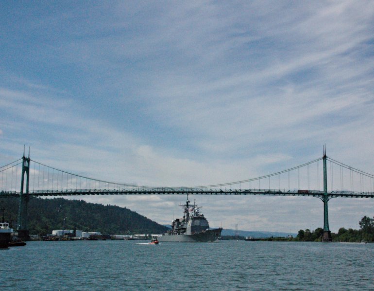
Sunday Bridges: St. Johns Bridge
See lots of Sunday Bridges here.
A US Navy ship crossed underneath the St. Johns Bridge on the Willamette River, June 9, 2011, during Rose Festival Fleet Week.
Carries U.S. Route 30 Bypass
Crosses Willamette River
Locale Portland, Oregon
Maintained by Oregon DOT
Design Suspension bridge, Art Deco
Total length 2,067 ft (630 m)
Longest span 1,207 ft (369 m)
Clearance below 205 ft (62 m)
Opened June 13, 1931
From Wikipedia:
The St. Johns Bridge is a steel suspension bridge that spans the Willamette River in Portland, Oregon, USA, between the St. Johns neighborhood and the northwest industrial area around Linnton. It is the only suspension bridge in the Willamette Valley and one of three public highway suspension bridges in Oregon. It is also the farthest north of any bridge on the Willamette.
The bridge has two 408 ft (124 m) tall Gothic towers, a 1,207 ft (368 m) center span and a total length of 2,067 ft (630 m). The adjacent park and neighborhood of Cathedral Park, Portland, Oregon are named after the Gothic Cathedral-like appearance of the bridge towers. It is the tallest bridge in Portland, with 400 ft (122 m) tall towers and a 205 ft (62 m) navigational clearance.
By 2001, average traffic on the bridge was 23,800 vehicles/day.
History:
Designed by internationally renowned engineer David B. Steinman (1886-1960) and Holton D. Robinson, of New York, the St. Johns was the longest suspension-type bridge west of the Mississippi River at the time of construction. It is the only major highway suspension bridge in the Willamette Valley and one of only three major highway suspension bridges in Oregon.
At the time of the proposal to build the bridge, the area was served by a ferry that carried 1000 vehicles a day. The proposal for a bridge was initially met with skepticism in Multnomah County, since St. Johns and Linnton were over five miles (8 km) from the heart of the city, and local business owners had minimal political clout. But after a lobbying effort that included a vaudeville-style show performed at grange halls and schools throughout the county, voters approved a $4.25 million bond for the bridge in the November 1928 elections. Initially a cantilever bridge was proposed, but a suspension bridge was selected due to an estimated $640,000 savings in construction costs.
The construction of the bridge began a month before the Stock Market Crash of 1929 and provided many county residents with employment during the Great Depression. Because of its proximity to the Swan Island Municipal Airport, some government officials wanted the bridge painted yellow with black stripes. County officials waited until St. Patrick's Day 1931 to announce that it would be painted green.
Dedication of the bridge was put off for one month in order to make it the centerpiece of the 23rd annual Rose Festival. It was dedicated on June 13, 1931, and during the ceremony, the bridge engineer, David B. Steinman said: "A challenge and an opportunity to create a structure of enduring beauty in the God-given wondrous background was offered us when were asked to design the bridge. It is the most beautiful bridge in the world we feel.”
The bridge was built within 21 months and one million dollars under budget. At the time of its completion, the bridge had:
the highest clearance in the nation, the longest prefabricated steel cable rope strands, the tallest steel frame piers of reinforced concrete, the first application of aviation clearance lights to the towers, and longest suspension span west of Detroit, Michigan.
In the summer of 1949, 15-year-old high school student Thelma Taylor was abducted and held by her captor, Morris Leland, under the east side of the bridge (which was undeveloped at the time, now the location of Cathedral Park, Portland, Oregon), and was eventually murdered there. The crime shocked the city and her killer was apprehended and put to death.
It was not until the Marquam Bridge in 1966 that another non-movable bridge would be built in Portland.
By the 1970s, the bridge had been allowed to deteriorate, and cash-strapped Multnomah County asked the state to take over maintenance. Initially, the state declined, since it was also suffering from a lack of funds. But pressure from an association of county governments forced the state government to take it over on August 31, 1975. A county official estimated the move saved them $10 million during the first ten years of state maintenance.
In summer 1987, General Motors filmed the introductory commercial for the 1988 Buick Regal in Portland, Oregon and vicinity, including the St. John's bridge, the Astoria-Megler Bridge, and on the Columbia Gorge.
Portions of the east approaches and east span were repainted beginning in 1987 and completed in 1994. In 1999 the Oregon Department of Transportation announced a $27 million rehabilitation project that began in March 2003 and was completed in the fall of 2005. Included in the project was replacement of the deck, repainting of the towers, water-proofing the main cables, lighting upgrades, and improving access for bicycle and pedestrian traffic. By November 2004, renovation costs soared to $38 million, due mostly to the need to replace nearly half of the 210 vertical suspender cables. During the project, the bridge sidewalks were closed at all times. In addition, the entire bridge was closed at night and continuously for a month. The newly refurbished bridge was rededicated on September 17, 2006.
In Pop Culture
In the film Pay It Forward, Jerry (James Caviezel), a homeless man who was the first person helped by Trevor (Haley Joel Osment), talks a woman out of jumping off the St. Johns Bridge.
Saturday, December 03, 2011
A citizen and citizens who occupied Portland going in opposite directions. Who will ultimately pay the price for Occupy Portland?
Starting Monday I will share with you various photos I've taken over the years of both Lownsdale and Chapman Squares. I need to see the parks as they were. I need to see people enjoying all sorts of activities in two of my favorite downtown places.
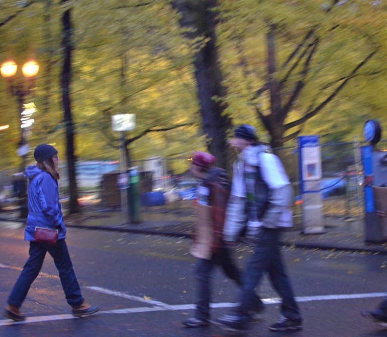
Monday morning on the way to work, November 14, 2011. I waited on the corner across the street from Lownsdale and Chapman Squares to the north and Terry Schrunk Plaza across the street, east of where I stood. The three parks occupied headlines because someone or someones in Occupy Portland decided to put up tents and take away these glorious outdoor spaces in the heart of downtown Portland, to take them away from more than 99% of Portland's citizens. The woman walks east on SW Madison; the other two are heading west. It is the intersection of SW 4th and SW Madison. The trees of Chapman Square are in the background.
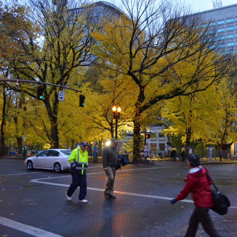
In another photo of the same intersection which I took that morning, across the street you see Chapman Square glowing in the street lights and in the giant temporary lights brought in Saturday night by authorities. The golden leaves on the ground are beautiful but are an allusion. Nothing is as it was.
The day before I took the two photos, after midnight and during Sunday, police and protesters managed to make the Occupy Portland exit from the parks relatively peaceful. I sat up all night Saturday watching events unfold on TV--the mayor had announced that the parks would be officially closed at midnight. Hours passed with tension building and waning. Finally I couldn't stay awake in the recliner in front of the television. But I did wake up now and then to see fewer and fewer people and police on the streets. Then I went grocery shopping with Lamont and came back home to put it all away and fall asleep some more in the recliner. By the time I woke up for good, both parks were cleared and lots and lots of trash and garbage was being tossed into huge city dump trucks. Each park was enclosed in extra-tall cyclone fence segments. The damage done to Terry Schrunk Plaza, a federal park, was minimal compared to the two city parks. Nevertheless, it is also fenced.
Now all citizens have learned the expected costs to restore Chapman and Lownsdale Parks. Here is an article about it from the November 30, 2011, Oregonian:
Headline: Occupy Portland: Costs to fix parks now more than $85,000, city says
Restoring Chapman and Lownsdale squares after the 38-day encampment of Occupy Portland will cost more than $85,000, with much of that going toward repairs in the bathrooms at the northern and southern ends of the squares.
Portland Parks & Recreation also estimated that it spent an additional $45,000 for labor and materials during the political demonstration that began Oct. 6 and ended with a police sweep Nov. 13. At its height, the encampment sheltered and fed about 500 people living in tents.
"City professional staff in ecology, turf, and structural engineering assessed the damages and needs for repairs," a city statement said. Also on the survey were arborists, plumbing contractors, electricians, risk management employees and other experts.
"Workers did not encounter any evidence of obvious soil contamination," the statement said. The impacts on the squares' trees will not be known until the spring or later.
The item of greatest cost is repair of the Lownsdale Square restroom – removal or replacement of three destroyed toilets, one pedastal sink, plumbing in the walls, wall-mounted braces and floor attachments. The city estimates that task alone will cost about $28,000.
A yet-to-be-determined cost is a possible sewer repair in the Chapman Square restroom.
The Regional Arts & Culture Council is still assessing the damage to the public art and war memorial and has not put in a cost estimate yet.
The bureau now will work on a timeline for repairs. The squares have been fenced since Occupy's eviction and will stay that way for now. Once the parks are reopened, grass areas will remain fenced until the turf has recovered.
The bureau says it is eager for volunteers to help. A planned leaf-raking last week had to be postponed due to heavy rain, but the bureau had more than 60 people signed up – about a third of them former campers – to help.
The nonprofit Portland Parks Foundation has set up the Restore Our Historic Squares Fund to help defray costs.
Umpqua Bank has contributed $25,000, and nearly 100 private donors have given $8,000.
Here's the city's itemized list:
Repaint restroom interiors, exterior trim at Chapman and Lownsdale: $2,200
Steam clean surfaces - restroom interiors, benches, poles: $3,000
Replace two park benches, repair seven benches: $16,500
Replace five chain stands, one chain section: $4,000
Power wash paths: $1,600
Soda blast exteriors of bathrooms to remove graffiti: $1,100
Rake turf to remove leaves and debris: $600
Install erosion control for turf: $1,000
Winter turf care: fill low areas, hydro mulch, lime, fertilize, seed, enzymes: $8,100
Spring turf care: fine grade, slice seed, top-dress: $3,800
Prune shrub beds to correct damage, replace damaged plants, fertilize, mulch: $4,000
Inspect, monitor trees: to be determined
Place soil to cover exposed tree roots: $750
Chapman restroom, clean sewer, inspect, repair as needed: $600
Chapman restroom, repair sewer as needed: to be determined, potentially up to $7,000
Chapman restroom, tile and grout repair: $700
Chapman restroom, reinstall door, jamb and frame: $2,500
Both restrooms, refurbish octagonal windows, includes frames, reglaze: $2,300
Lownsdale restroom: remove or replace three destroyed toilets, one pedestal sink, repair plumbing in walls, wall-mounted braces, floor attachments: $28,000
Lownsdale restroom, repair door lock: $100
Lownsdale restroom, tile and grout repairs: $1,800
Temporary fencing: $3,200
-- Anne Saker
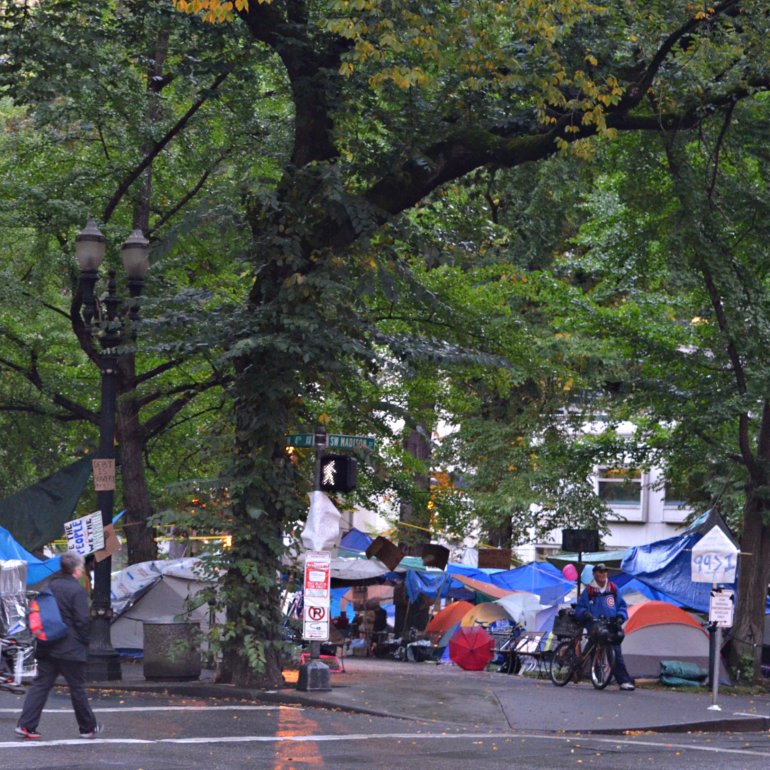
A view of the same intersection five days after the occupiers took over the parks, taken on October 11.
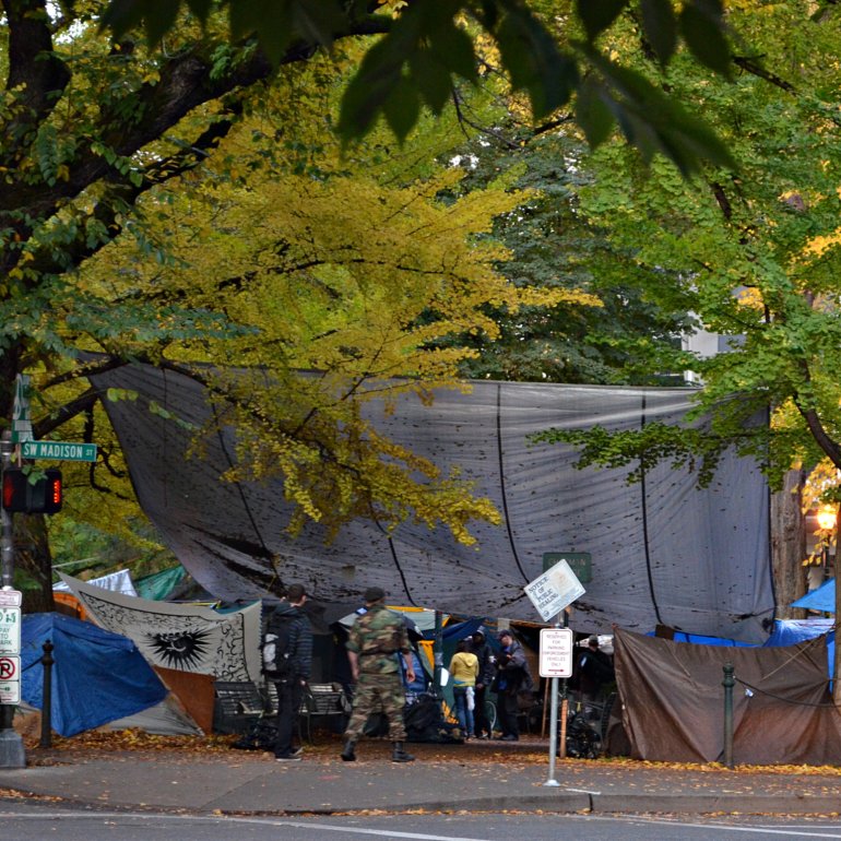
And here it is again, in a photo that I took on November 3.
To answer my own question, I believe it will be the citizens who pay the price. Whether or not the various occupy events around the country make an economic and/or cultural difference remains to be seen. After all, change takes time.
Labels:
Chapman Square,
damage,
Lownsdale Square,
Occupy Portland,
parks,
price
Friday, December 02, 2011
#9, Hawthorne Bridge, focus on the circle between the eastbound & the westbound ramps and/or the intersections of the ramps with the surface streets
I took these photos on Thursday, December 1, about 7:30 a.m.
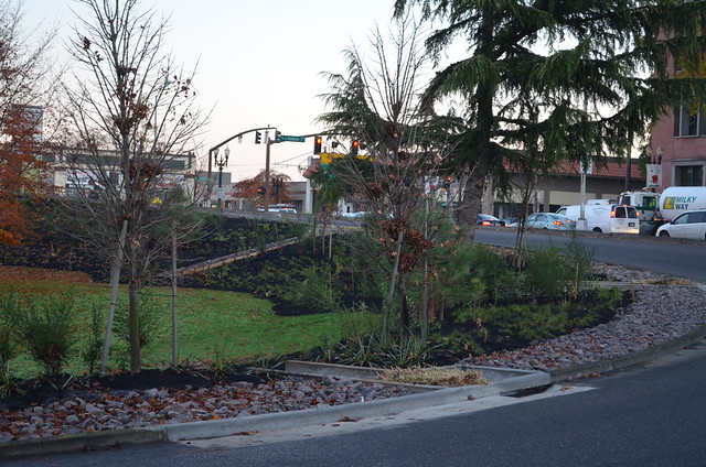
A close view of the finished sidewalk around the edge of the circle. This sidewalk is a massive improvement over what used to be there. I imagine its being there will encourage people to walk on that side of southbound MLK. The trees next to the sidewalk were planted early this week--the holes were dug last Wednesday, a day of high wind and rain. No one worked on Thanksgiving Day, plus I noticed that the trees were still lying on their sides, just like they'd been left on Wednesday. The street that goes out of sight beneath the westbound ramp of the Hawthorne Bridge is SE MLK. If you look closely, you can see the Big Pink rising in the distance at the left side of the photo.
Another edge of the circle where you can see three of the built-into-the-curb drains, the rock placed between the plantings strip and the curb. That angled strip of gray is the rock-filled run-off from the drain you can see in Wednesday, 11/30/2011's post, the third of three photos. In this photo the cars and the truck with Milky Way written on it are stopped at the light at SE Grand Avenue and SE Madison. The traffic goes one way north on SE Grand.
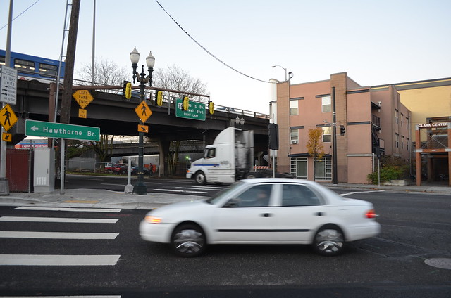
And here we have the completed sidewalk across from the circle. The crosswalk is completely new, the handicapped ramps, the truncated domes matts, and the stripes on the street. The Hawthorne Bridge with the arrow pointing left takes drivers around the circle and onto the westbound ramp--that's where the white car is headed. The white tractor is headed south on SE MLK. By the time the streetcar is operational next September 21, the traffic signal will be functional so that people who exit the streetcar on the far side of SE MLK will be able to cross safely. The streetcar stop is just out of sight to the right edge of the photo.
Now, the posts about this transformation are finished. Until something else major happens, we'll say good-bye to this subject which totally intrigued me throughout.
Thursday, December 01, 2011
#8, Hawthorne Bridge, focus on the circle between the eastbound & the westbound ramps and/or the intersections of the ramps with the surface streets
It's Theme Day at lots and lots of City Daily Photo Blogs. Click here to view thumbnails for all participants who have posted an Action Shot for your enjoyment and/or edification.
A - Angle of the raised dump truck bed.
C - Circle being reworked for to the fall, 2012 arrival of the Portland Streetcar Eastside Loop.
T -Tamp Tightly like the man with the shovel in the top photo.
I - Interest I have taken in these goings on.
O - One of these days this series of posts will be complete.
N - Not a moment too soon, I'm sure some frequent visitors will testify.
S - Smoothing accomplished by that wheeled contraption in the bottom photo.
H - Hot asphalt.
O - One more sidewalk to finish; take a close look at the bottom photo.
T - Tell me what you think of my ACTION SHOT, please and thank you!
The person closest to the back of the dump truck operated some sort of latch which opens some sort of chute and allows the hot asphalt to stream out onto the street, in a narrow, elongated hump-like shape. Looks to me like the next man is tamping it down with a shovel, tight as he can get it against the new curb on the new sidewalk on the inside of the circle.
Next thing I know, the first-laid asphalt has been rolled over by that wheeled contraption the man is riding and driving. See how smooth it looks up against the curb? You can sort of see the slight dip for the truncated domes matt at the handicap section of the sidewalk, too. Now the wheeled contraption is flattening the asphalt up against the newly formed curb across the street. And asphalt is being dropped out of the dump truck to complete the entire surrounding of that point of curb. There is still no concreted sidewalk completed there, though. Up on the eastbound Hawthorne Bridge ramp you can see two men working with a traffic diversion sign of some sort, so you know that work surely continues at or close to the intersection of SE Hawthorne and SE Grand.
Wednesday, November 30, 2011
#7, Hawthorne Bridge, focus on the circle between the eastbound & the westbound ramps and/or the intersections of the ramps with the surface streets
I look outside on November 17.
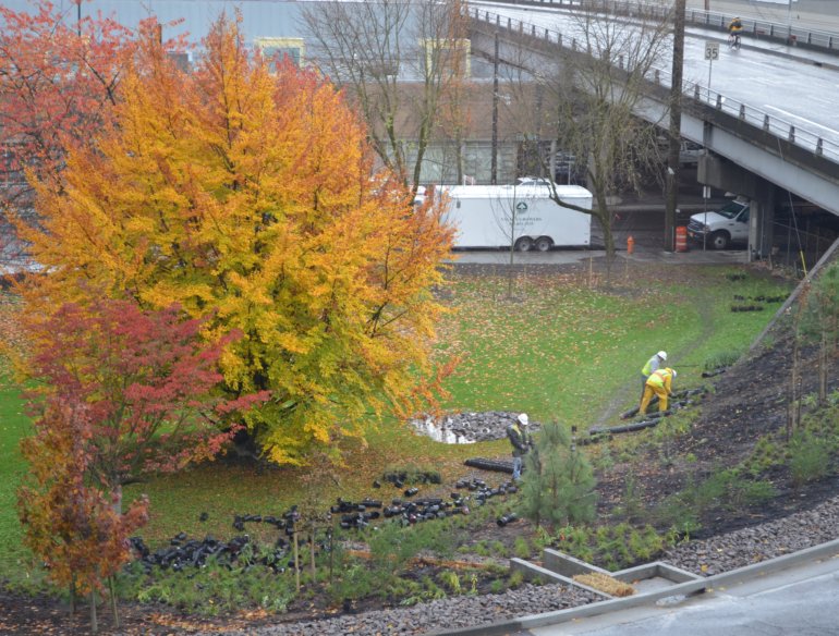
At first I didn't see anything other than lots and lots of black cylinders, tossed everywhere on the green grass in the circle.
Then I saw these three men, working at gathering what turned out to be black pots. It makes sense to plant as much as possible on a slope, in addition to the trees which had been planted days before. Hopefully the roots will soon grab hold of the freshly placed dirt and remove the chance that it will erode during Portland's wet winter. You can see the gray-colored path the men made, walking back and forth from their white trailer parked on SE MLK to the bottom of the slope. It says Valley Growers on the side of the trailer.
They or some other nurserymen returned at some other point and planted even more on the slope which goes up to the westbound bridge ramp, on the right of the photo where the dirt is bare. Notice the puddle beside the pile of rocks near the bottom edge of the fall foliage? There is a pretty-good-size pipe resting on the rocks. Your view of it is blocked by the man stacking black pots together, but you can see it in the photo above this one. I am assuming that is the drain for at least one of the several small-box-culvert-looking drain devices built at intervals into the curb--you can see one at the bottom right corner. I believe that bale of hay helps slow down the flow of water which enters through oval-shaped hole in the curb.
Labels:
black pots,
circle,
erosion,
Hawthorne Bridge,
SE MLK,
slope,
Valley Growers
Tuesday, November 29, 2011
#6, Hawthorne Bridge, focus on the circle between the eastbound & the westbound ramps and/or the intersections of the ramps with the surface streets
On such a sunny day, working outside with a task one could accomplish must have been a rewarding activity.
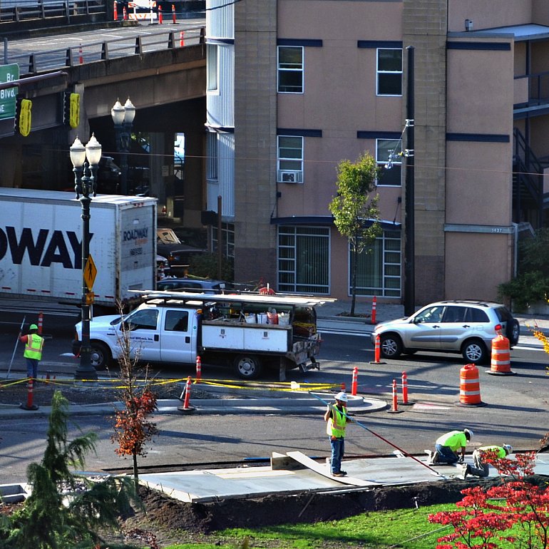
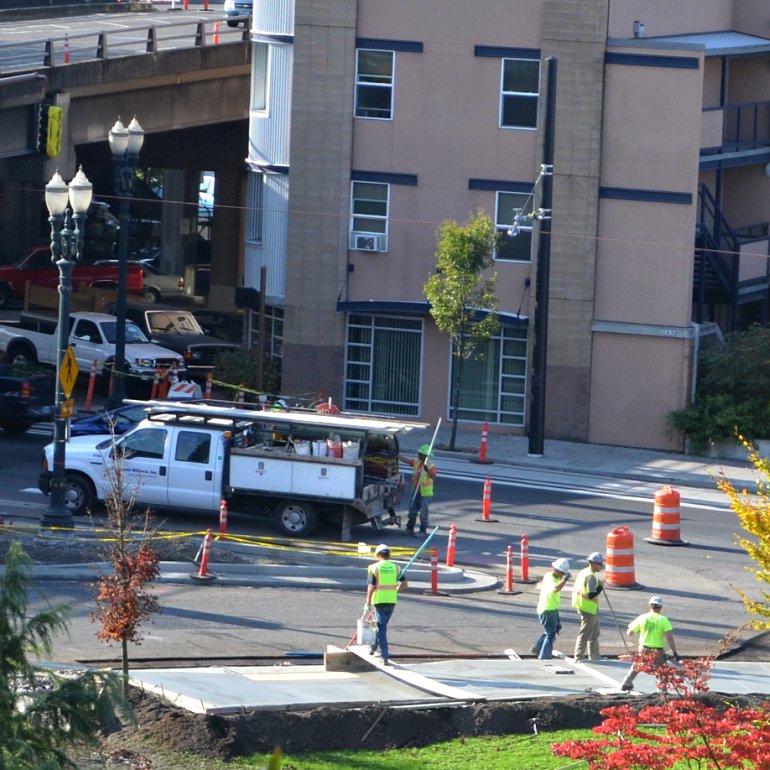
I took this photo later in the day from when I took the photo on Monday's post, a little over four hours later. A crew poured the rest of the sidewalk on the inner edge of the circle. The white truck is pulled to the curb on SE MLK, which is a one-way street, southbound. The bridge ramp above it is the eastbound exit ramp of the Hawthorne Bridge. The Ross Island Sand & Gravel truck is pulled to a stop on the circle. The man on his knees is creating a recess for the installation of the yellow vinyl section of truncated domes, that rectangle that looks sort of like permanent, wide-spaced, opaque, yellow bubble wrap which you see along the edges of subway stops and in the handicapped ramps from sidewalks down to street level. Truncated domes, which meet ADA requirements, serve as a detectable, tactile warning surface for the visually impaired. I myself like to stand on them at corners while I wait for the light to change, unless there is a visually impaired person there, too. My feet enjoy the massage. You can see what looks like two pieces of yellow, one on each side of him as he scrapes and smooths. I for one am glad to see that the sidewalk is as high off the surface of the circle as it is--I doubt that rain will stand on that sidewalk, ever.
The truncated domes matt has been installed, near the end of the plank the man is standing on near the bottom center of the photo. Now these men are continuing to finish the sidewalk's surface. The man on the left is using a pad attached to the extended-length handle. The other two men are on their knees, smoothing by hand.
In this photo you see more finishing work in progress. The man walking on the plank is crossing back to the street because he has finished using the extended-length handle and pad on the concrete. And you can see the slightly different colored rectangle to the left of where steps, there in the gray concrete. That is the truncated dome matt. The planks that cross from one side of the sidewalk to the other were moved to the right a few feet, and the work continued.
Labels:
circle,
finishing concrete,
Hawthorne Bridge,
ramp,
SE MLK,
sidewalk,
truncated domes matt
Monday, November 28, 2011
#5, Hawthorne Bridge, focus on the circle between the eastbound & the westbound ramps and/or the intersections of the ramps with the surface streets
I took Saturday and Sunday off, chilled and painted with acrylics on canvas board and such. I'm back now.
On November 10, the view from SE MLK, looking east. I was so taken with the BUMP sign that I failed to notice the area to its right, ready to become the rest of a new section of sidewalk. You see, previously along the edge of the circle, no sidewalk existed, just a narrow paved path with a handicapped ramp to street level, but no crosswalk or signal for the handicapped to use in crossing the circle, however. You can see the ramp and the no crosswalk clearly here.
This photo illustrates what I had said here about the circle reminding me of a tilted bowl. See how much higher the circle looks where the pavement disappears into the leaves on the tree? And see the traffic through the guardrail? That traffic is heading north on SE Grand Avenue. The traffic signal with the One Way sign at the right edge of the photo is the second photo in this post.
Subscribe to:
Posts (Atom)