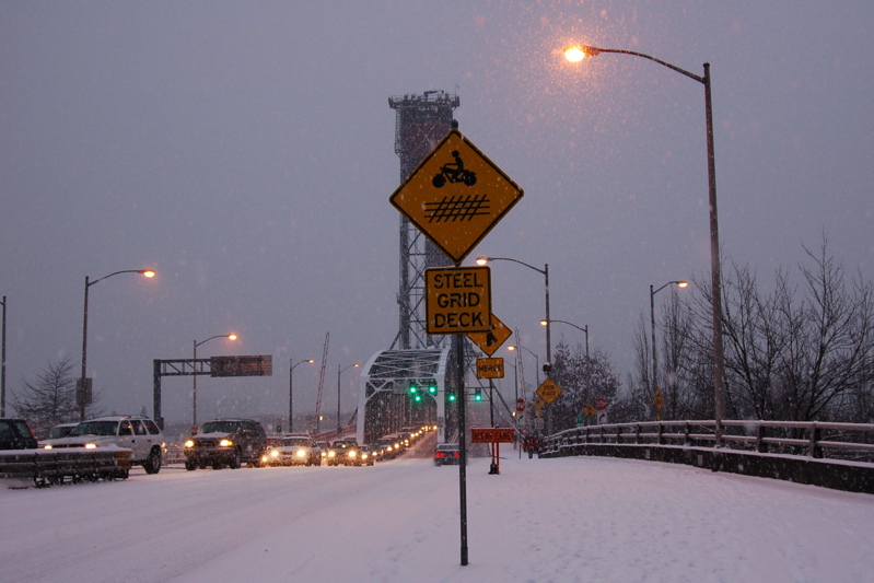
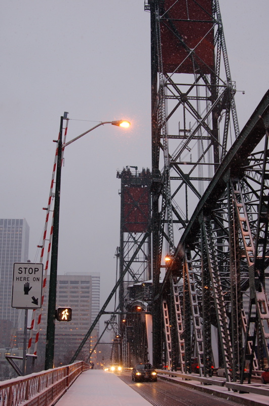
Here's the sidewalk that heads up 2nd on Madison and continues on over the Hawthorne Bridge. You can tell it's snowing quite a bit. See the yellow sign that says, "Steel Bridge Deck." That means that a good portion of the bridge is that metal surface that makes one think the car is going to have a mind of its own and go sideways at any moment. For that reason, I always drive across this bridge on the outside lane, going east or going west. That allows me to have all sorts of steel bridge parts between me and any oncoming traffic. I like that. Notice the street lights are still on, and it's around 8 a.m.

I've just about made it to the steel bridge deck, with its open grating. How about that "Slippery When Wet" sign? Comforting. Nope. But I was not having any trouble with the snow, just stepping slowly and carefully, thinking about where I was putting each foot. I believe it was just past that person on the sidewalk, where the steel part starts, that I noticed a rather wide gap in the snow. Fear sent a shudder through me. I just knew that if I looked down, I'd see the river through that space. So, determined at all costs not to look down, I stepped out slowly, took a giant step over it and breathed a sigh of relief. All across the bridge, smaller gaps showed up, but I just kept on stepping over them without looking down. Another thing that helped me not to be as afraid as I thought I'd be was the plentiful snowfall. It kept the river sort of blocked from my vision, not that I looked down at it at all, but I felt a comfort in knowing that if I accidentally looked, the distance down to the water would be broken up by the snowflakes. How irrational is that? It worked for me.
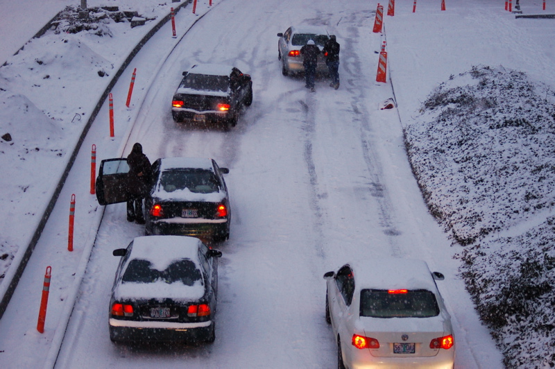
As I made my way up the sidewalk towards the bridge proper from 2nd and before the photo above, I noticed these men pushing a car up a slight incline on the Naito Parkway, which used to Front Street. Just last Saturday, I think it was, this thoroughfare reopened after a lengthy closure for construction and remodel. I was glad I was on foot.

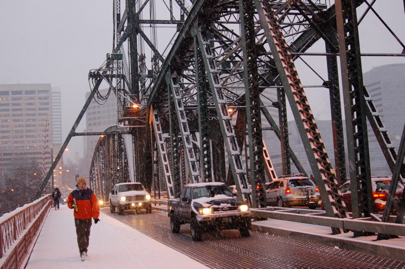
A lot of people ride bicycles in Portland, even in deep snow it seems. In the background is the River Place Hotel where Lamont used to be the sous chef until he regained his senses and returned to 3 Doors Down Cafe. The guy on the bike is in Tom McCall Waterfront Park, a very popular park, almost 30 acres, along the Willamette River.

Here's a wide shot of Naito Parkway a few seconds later that the closeup above. Nothing seemed to be slowing those helpful guys pushing the car.
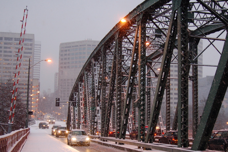
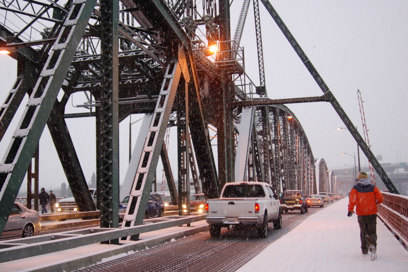
This is close to the middle of the bridge, looking west, back the way I'd come. Those two trucks are where I like to drive. You can see why. Look at those big beautiful steel bridge parts, that wide sidewalk and that railing, all between me and the river, and me and the traffic! How comforting.
Here's a blatant out-of-order mess. That red and white barricade on the left of the bridge is way before the middle of the bridge when you're walking westward. It marks the spot where all eastbound traffic has to stop and wait when the bridge is being raised to allow big ships to pass up river.
Here's what Wikipedia has to say about the Hawthorne Bridge (I left out the citations--shame on me, the ex-librarian):
The Hawthorne Bridge is a truss bridge with a vertical lift that spans the Willamette River in Portland, Oregon, joining Hawthorne Boulevard and Madison Street. It is the oldest vertical lift bridge in operation in the United States[1] and the oldest highway bridge in Portland. It is also the busiest bicycle and transit bridge in Oregon, with over 4,800 cyclists[2] and 750 TriMet buses daily.[3]
The bridge consists of five fixed spans and one 244 ft. long vertical lift span. It is 1,382 feet in total length. The 880,000 pound counterweights are suspended from the two 165 ft. tall towers. While the river is at low level the bridge is 49 feet above the water, causing it to be raised an average of 200 times per month. As of 2001 the average daily traffic is 30,500 vehicles. The bridge was designed by John Waddell, inventor of the vertical lift bridge and also designer of the Steel and Interstate bridges.
The current bridge was built to replace Madison Bridge No. 1 (1891) and Madison Bridge No. 2 (1900), which was destroyed by a fire in 1902. It cost $511,000 to build and was opened on December 19, 1910. [4]
The deck was changed from wood to steel grating in 1945. In 1985 the lift span sheaves, the grooved wheels that guide the counterweight cables, were replaced. The bridge went through a $21 million restoration from 1998-99, which included replacing the steel grated deck and repainting.[5] The original lead-based paint was completely removed and replaced with 3 layers of new paint that is estimated to last 30 years.[6] During this upgrade the sidewalks were widened to 10 feet, making it a thoroughfare for bicycle commuters. In 2001 the sidewalks were connected to the Eastbank Esplanade. The estimated cost to replace the bridge is $189.3 million. [3]
Hawthorne Boulevard (and thus the bridge) was named after Dr. J.C. Hawthorne, the cofounder of Oregon's first mental hospital and early proponent for the first Morrison Bridge.[7]
Now I've made it past the halfway point. Hooray. That red and white barricade is to keep westbound walkers, runners, and bicyclists from continuing on when the bridge is about to be raised. You can see one of the towers that house the counterweights that raise the bridge.
Here I'm at the almost middle point, looking east. There's a good look at the steel deck if you click on the photo to enlarge it.
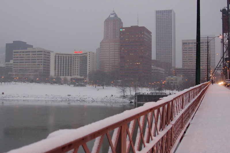
I wonder how many people work in just one of Portland's big downtown buildings? Just a few of them are here in this shot, along with a portion of the snow-covered Tom McCall Park. I like the way the snow looks on the railing, don't you?
Talking about this bridge reminds me I need to tell you about a great book I got the first week of January at Powells Books. "The Portland Bridge Book" and its authors Sharon Wood Wortman with her husband Ed Wortman made an appearance on a Wednesday evening. What a good time I had as both of them talked about all of these wonderful bridges that join the west and east of Portland together, over and over again from the north to the south. The book is great; if you love bridges, you should look at it at www.powells.com. The photos are splendid, both old and new ones. Sharon takes people on bridge walks, something I want to do to help me overcome my fear of heights and bridges. Her Web site is www.bridgestories.com.
My goodness, I'm just reading about the Hawthorne Bridge in my new book. It says that 800 TriMet buses cross it every day (a part of 30,000 vehicles.) I usually ride two of them, Monday through Friday. Neat. And 5,000 bicyclists use it daily. My word.
Oh, the beautiful railing, it says in the book, was that high to keep horses from jumping off the bridge. The Hawthorne Bridge opened in 1910. I'm going to be at the 100th birthday party that Sharon and Ed are planning.

I'm almost all the way across the bridge. Wowsers. Notice the pedestrians on the other side of the bridge? (When I got to work, folks who'd been watching out the windows told me that a westbound bus got stuck trying to go up the entrance ramp to the bridge, so all of the people got off and started walking.) That bridge deck up above is the lower deck of the Marquam Bridge which also has an upper deck. The Marquam Bridge carries Interstate 5 north and south through Portland.
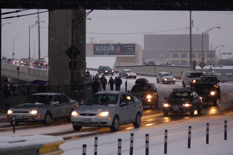
Now I'm am all the way across the part that goes over the river. I can breathe a little bit better although I can still easily see that I'm up above streets and rooftops. There comes some more people from that stuck bus, (They're walking were I was to walk that afternoon when a bus didn't come and didn't come once I got off work . . . more later.)
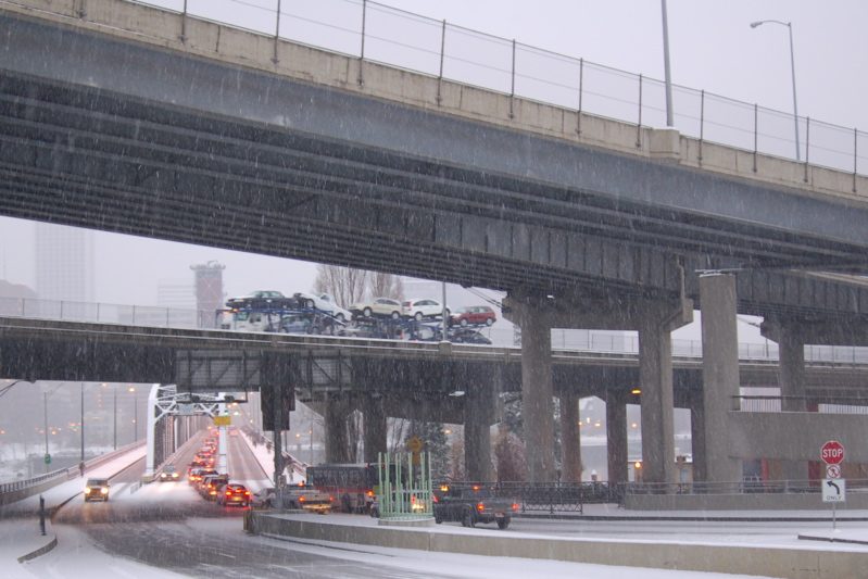
Look at that snow falling! It shows up really good against the Marquam Bridge's two decks. In no time at all, I was off the bridge and its ramp that connects it to Hawthorne Blvd.
I had made it to work (and the facilities) because I knew I could.
After all, I had recently driven both directions across the Fremont Bridge, another story in itself. Once I get some photos of it, I'll go into detail. (I know you're all waiting with baited breath.) Suffice it to say that the lower deck is 175 feet above the water; it's upper deck is even higher, naturally. Just looking at it from other bridges filled me with dread. But a couple of days after I'd driven over it (sort of an accident of planning thanks to Mapquest), I thought, "I've driven over the Fremont Bridge; I can do anything." And today I did!
No comments:
Post a Comment