Showing posts with label Burnside Bridge. Show all posts

Monday, October 14, 2013

The short-lived snag

Click here for a trip to City Daily Photo, transporting you around the world every day.

I know I promised this on Sunday, but I didn't feel very well all day--felt a chill, didn't even make it to my Northwest Film Center's Reel Music Festival documentary, THIS AIN’T NO MOUSE MUSIC!
DSC_0909_PM

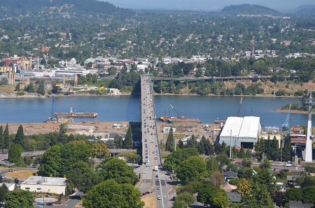
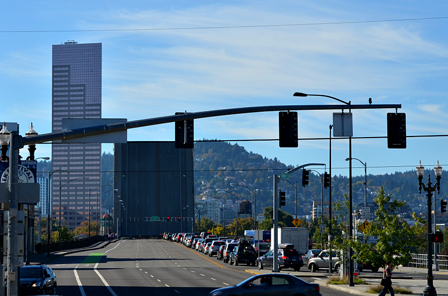
I walked to the corner of SE Grand Avenue and East Burnside. When I stopped at the bus shelter, I immediately noticed that the Burnside Bridge was up. The snag. I'm on the east side of the Willamette, waiting for an eastbound bus which is coming from the other side of the Willamette River. I took this photo at 3:02 p.m. By 3:07, the bridge was closed and traffic appeared in the eastbound lanes. Naturally, I don't know the entire length of time that the bridge was open, just the span of time from when I saw it completely open until it was completely shut--I'd say five minutes is a short snag when something that huge is involved! Soon the bus came and I rode home. In another example a serendipitous positioning of structures in a photo, look at the line up here--the Big Pink, the Burnside Bridge's Italian Renaissance tower where sometimes there is an operator inside, and the open bridge structure. I'm a huge fan of serendipity!

I'll never forget the first time that I drove west on Burnside back when we lived in Northwest Portland. I was headed across the river, can't remember why now, but as I got closer to the bridge, my mind filled with confusion as I realized cars were stopped in front of me. Then I saw a big shape on the horizon and thought, "They're moving a house across the bridge. Nope! That's the bridge! It's up!" My first time ever to approach an open bridge in Portland. What a treat!

Here's information from the Multnomah County Web site about the Burnside Bridge:

One of four Willamette River crossings built in Portland during the "Roaring Twenties," the Burnside Bridge stands in age right behind the County's Hawthorne and Broadway bridges.

This 1926 structure is located on one of the longest and busiest streets in the Portland area. The five-lane Burnside is a direct connection between downtown Portland, Beaverton to the west and Gresham to the east. Last year, about 40,000 vehicles a day used it. So did more than 1,000 pedestrians and bicyclists each day.

In addition to its important daily work load, Burnside plays a key role during emergencies. Burnside Street and bridge are designated as an official emergency transportation route. The bridge, as part of this "lifeline corridor," is the one non-freeway river crossing which emergency vehicles and suppliers are asked to use.

Burnside's artistic side

The three-span Burnside is a historically significant structure. It is the only Willamette River bridge in Portland designed with the help of an architect, a result of the early 20th century City Beautiful Movement that called for adding architectural ornamentation to engineering designs. The bridge's distinctive Italian Renaissance towers reflect the trend. Burnside is eligible for the National Register of Historic Places and protected by preservation laws. Originally designed by the firm of Hedrick and Kremers, Burnside was completed by Gustav Lindenthal (1850-1935). Burnside's opening mechanism, or bascule, was designed by Joseph Strauss (1870-1938), whose Golden Gate suspension bridge would open 11 years after Burnside.

The Burnside Bridge main river structure consists of two 268-foot side span steel deck truss side spans and a 252-foot double-leaf Strauss trunnion bascule draw span. The bridge originally had six lanes of traffic, but in 1995 the City of Portland requested that bike lanes be added to the bridge, so one lane of traffic was converted into two bike lanes. There are sidewalks on both sides of the bridge. The overall width of the structure is 86 feet. Vertical clearance of the closed bascule span is adequate for the majority of river traffic, with openings necessary only about 40 times per month.

Only minor modifications have been made to the bridge since its construction. Electric street car rails were removed in the late 1940’s, lighting and traffic control devices were updated in the late 1950’s, automobile traffic gates were installed in 1971 and the bascule pier fenders were replaced in 1983. Several deck resurfacing projects and expansion joint repairs have also taken place.

The east approach to the bridge is approximately 849 feet long and has two distinct types of construction. The first eight spans consist of steel plate girder spans ranging from 75 feet to 106 feet in length. The steel girders and steel interior floor beams are completely encased in concrete. A concrete deck spans the floorbeams. The next seven spans are composed of concrete stringers spanning continuously over concrete columns and floorbeams. Six of these spans are 22 feet long and one is 40 feet long.

The west approach is approximately 604 feet long and consists of 19 reinforced concrete spans ranging in length from 22 feet to 62 feet. The first 13 spans average 22 feet and consist of reinforced concrete stringers acting continuously over concrete columns and floorbeams. The next three spans average 40 feet in length and are of similar construction. The last four spans are 62 feet long and consist of four main simple span concrete girders that carry interior concrete floor beams and stringers. A concrete deck is cast with the girders, stringers and floorbeams.

And a bit about a bascule bridge:

Bascule bridges have sections that rotate upward and away from the centerline of the river, providing clear passage for river traffic. Side-by-side on the Willamette River in downtown Portland, the Morrison and Burnside Bridges are two examples of bascule bridges. These two bascule type bridges have a very clean, uncluttered look to them because the counterweights and operating machinery are located out of sight in the piers supporting the bridge. The Morrison Bridge is a Chicago-type bascule bridge, and the Burnside Bridge is a Strauss-type bascule bridge.

Sunday, January 13, 2013

Seen from a TriMet bus

Click here for a trip to City Daily Photo, transporting you around the world every day.

DSC_0501_cropped

On January 8, after I walked westward over the Hawthorne Bridge into downtown Portland, I ended up on the bus home which takes me eastward back over the Willamette River, on the Burnside Bridge. OK. I know what you're thinking right now--she's crazy, she goes west to go east, to get home after work! Yes, I work in Southeast Portland and live in Northeast Portland. But, I promise that there's a logical method to my madness. 

If I go straight north after work for 22 blocks by bus or walking to catch that last bus home on East Burnside at NE Grand Avenue, I have to stand up in the aisle of said bus, hoping I can balance myself from one of those high-up straps, for the 20 blocks until I come to where I get off the bus. Not always. Sometimes a person gives me, the senior citizen, his or her seat. And if I do stay on the east side of the Willamette River, you'd think I'd save some time, get home quicker. Nope. The only way I can save any time is if I manage to catch the streetcar right in front of my building, but I've only done that three times since it started running last September. 

If I catch a westbound bus after work, and I have three possibilities by 5:06 p.m. or so, I get off at SW 6th and SW Main, walk three blocks north and catch the last bus home (I have two possibilities) in just a few minutes, and I get a seat. I feel much better about riding a bus when I am sitting in a seat, being a senior citizen and all. 

Anyway, I took this photo looking through the windshield from my seat on the bus last Tuesday. I like the red taillights and the red and green traffic signals; the row of green street signs on the left of the photo; and all of the white, double-light street lights. One of the best things about this photo is the huge neon sign for United Finance, atop their building on the northeast corner of East Burnside and SE Grand Avenue, the cross street. You can see the opposite side of the same sign, in Vintage Portland’s post with a 1963 photo of the Burnside Bridge. In order to thoroughly enjoy this fabulous photo, click on it to enlarge it, then click on it again to make it even larger. Then scroll towards the lower right corner--you'll have to scroll across and down, probably. You'll see the sign then. 

And if you scroll around to see more of the bridge itself and notice two white-roofed buses, one behind the other, on the left of the photo, the bus I was in when I took the photo above is in that lane and close to the intersection where the white car is making a turn south. That intersection was then Union Avenue, the cross street, and Burnside--in 1989 Union Avenue became Martin Luther King Jr. Blvd. Did you notice the green street sign in my photo? In the top right corner? NE Martin Luther King Jr. Blvd. is the street we're stopped at in the bus. The next green sign might be legible to you--it's NE Grand Avenue. 

Thanks to Vintage Portland, those of us who subscribe to it, as well as those who come across it randomly, get to see all sorts of fine vintage photos of our city and its environs!

Thursday, January 03, 2013

Seen either on or from a TriMet vehicle, be it bus or MAX, or maybe even the Portland Streetcar, which is not TriMet

Click here for a trip to City Daily Photo, transporting you around the world every day.

DSC_0357_cropped_big_pink

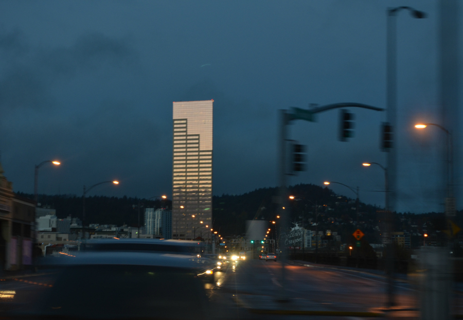
From the Portland Streetcar, headed to work, south on MLK, on November 21, 2012. As we made our way through the intersection with Burnside, I liked the way the streetlights along the sidewalks on the Burnside Bridge disappeared in the distance, as well as the shimmer of light on the Big Pink. 


I took three photos--this is the second one. I've put it here because the Big Pink is more in focus in it than in the other two. In the photo, the wide blur at the base of the Big Pink is a vehicle stopped at the traffic signal. 


I wonder if the driver thought I would get his/her face in the photo? No chance of that, not enough light. And, as you can tell by the blur, the streetcar was bookin' on down the street. I know that the blurry image is not driving along beside the streetcar because the streetcar tracks are adjacent to the curb without any sort of lane between them and the curb. 


Oh, before I forget, in this photo you get an idea where the Portland Oregon sign is located, the sign that is the image used as the header for my blog. It's on top of a building and only looks closer to the street because of perspective and distance.

Thursday, July 26, 2012

Seen from the TriMet 12 bus on the way home after work last Friday

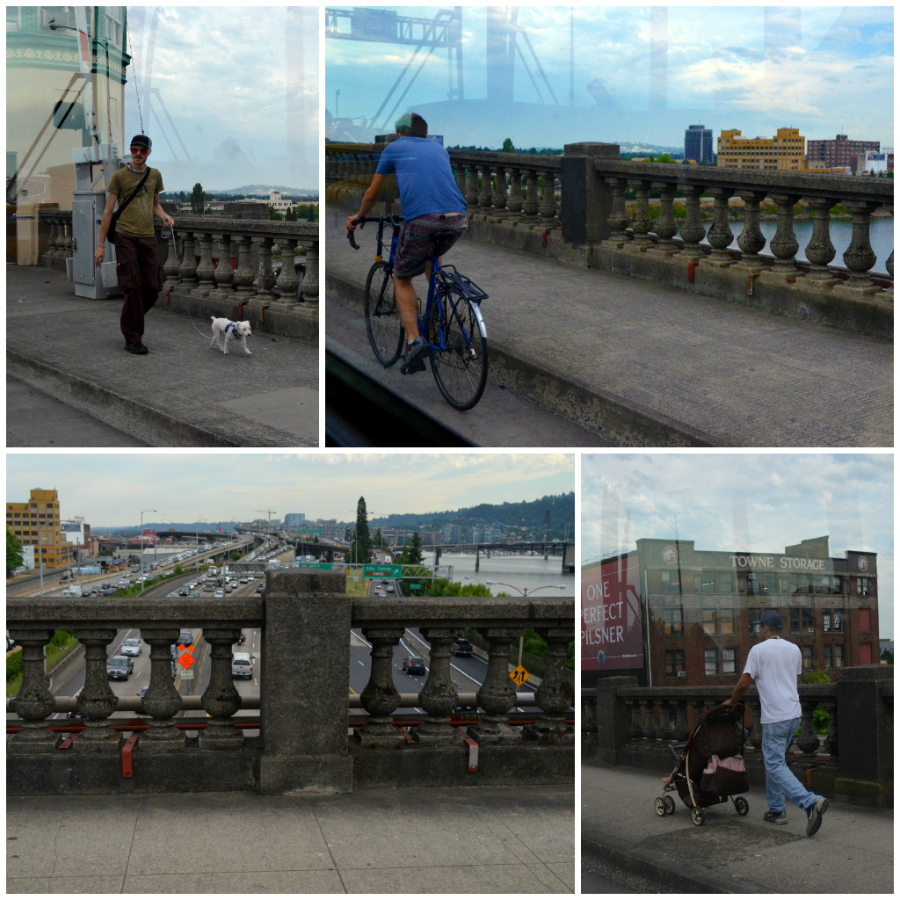
PicMonkey Collage_burnside_bridge_900_square

I decided to take one photo of someone we passed on the bus, which led to another photo, and naturally to others. Can't help myself, y'all. I love this city and what goes on here and there. We're heading east from downtown Portland on Burnside, the street that divides Portland into its north and south sections. And since the Burnside Bridge crosses the Willamette River, the east/west divider, at some point I must be in the exact center of the city. My photos: a man and his dog walk west with one of the Italian Renaissance towers reflected behind them; a man on his bicycle rides east; typical I-5 traffic, most of what you see is northbound; and a man with a child in a stroller, walking east.

About the Burnside Bridge, from the Multnomah County Web site:

One of four Willamette River crossings built in Portland during the "Roaring Twenties," the Burnside Bridge stands in age right behind the County's Hawthorne and Broadway bridges.

This 1926 structure is located on one of the longest and busiest streets in the Portland area. The five-lane Burnside is a direct connection between downtown Portland, Beaverton to the west and Gresham to the east. Last year, about 40,000 vehicles a day used it. So did more than 1,000 pedestrians and bicyclists each day.

In addition to its important daily work load, Burnside plays a key role during emergencies. Burnside Street and bridge are designated as an official emergency transportation route. The bridge, as part of this "lifeline corridor," is the one non-freeway river crossing which emergency vehicles and suppliers are asked to use.

Burnside's artistic side - The three-span Burnside is a historically significant structure. It is the only Willamette River bridge in Portland designed with the help of an architect, a result of the early 20th century City Beautiful Movement that called for adding architectural ornamentation to engineering designs. The bridge's distinctive Italian Renaissance towers reflect the trend. Burnside is eligible for the National Register of Historic Places and protected by preservation laws. Originally designed by the firm of Hedrick and Kremers, Burnside was completed by Gustav Lindenthal (1850-1935). Burnside's opening mechanism, or bascule, was designed by Joseph Strauss (1870-1938), whose Golden Gate suspension bridge would open 11 years after Burnside.

The Burnside Bridge main river structure consists of two 268-foot side span steel deck truss side spans and a 252-foot double-leaf Strauss trunnion bascule draw span. The bridge originally had six lanes of traffic, but in 1995 the City of Portland requested that bike lanes be added to the bridge, so one lane of traffic was converted into two bike lanes. There are sidewalks on both sides of the bridge. The overall width of the structure is 86 feet. Vertical clearance of the closed bascule span is adequate for the majority of river traffic, with openings necessary only about 40 times per month.

Only minor modifications have been made to the bridge since its construction. Electric street car rails were removed in the late 1940’s, lighting and traffic control devices were updated in the late 1950’s, automobile traffic gates were installed in 1971 and the bascule pier fenders were replaced in 1983. Several deck resurfacing projects and expansion joint repairs have also taken place.

The east approach to the bridge is approximately 849 feet long and has two distinct types of construction. The first eight spans consist of steel plate girder spans ranging from 75 feet to 106 feet in length. The steel girders and steel interior floor beams are completely encased in concrete. A concrete deck spans the floorbeams. The next seven spans are composed of concrete stringers spanning continuously over concrete columns and floorbeams. Six of these spans are 22 feet long and one is 40 feet long.

The west approach is approximately 604 feet long and consists of 19 reinforced concrete spans ranging in length from 22 feet to 62 feet. The first 13 spans average 22 feet and consist of reinforced concrete stringers acting continuously over concrete columns and floorbeams. The next three spans average 40 feet in length and are of similar construction. The last four spans are 62 feet long and consist of four main simple span concrete girders that carry interior concrete floor beams and stringers. A concrete deck is cast with the girders, stringers and floorbeams.

From Wikipedia: A bascule bridge (sometimes referred to as a drawbridge) is a moveable bridge with a counterweight that continuously balances the span, or "leaf," throughout the entire upward swing in providing clearance for boat traffic. Bascule is a French term for seesaw and balance, and bascule bridges operate along the same principle. They are the most common type of movable bridge in existence because they open quickly and require relatively little energy to operate. Bascule bridges may be single or double leaf. Both have any truss structure and counterweights below the deck.

Saturday, June 16, 2012

Vintage vehicle at Voodoo Doughnut & some colorful serendipity, downtown Portland

crowd_voodoo_doughnut_vintage_vehicle_BeFunky

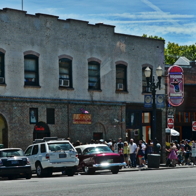
Today on the 12 bus, on the way to Killer Burger from downtown, I noticed a crowd outside the original location of Voodoo Doughnut. The reason that I got the chance to notice the crowd and the gorgeous vintage vehicle parked at the sidewalk was that the Burnside Bridge was near the end of a bridge lift, stopping traffic in both directions.

Actually, the crowd is a double line which snakes from out of sight on the right to just left of the original Voodoo sign on the brick wall at which point it snakes back towards the corner and the red-framed door. After I saw the crowd, I saw the wine-colored vintage vehicle. The way the sun hit the back chrome bumper and the back window made me stand up and walk to the front of the bus so that I could take this photo through the windshield, looking at an angle towards SW 3rd from the intersection where the bus waited for traffic to clear once the bridge lift completely ended.

Once I had downloaded the photo, I quickly noticed the girl in the pink sundress, playing the guitar on the sidewalk directly beneath the Voodoo Doughnut sign. Ah, serendipity--all of that wine and pink color right there, together.

bridge_lift_burnside_BeFunky

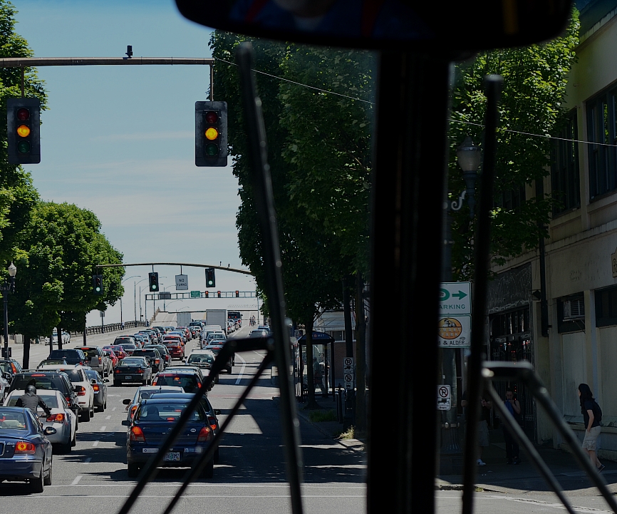
One more photo, taken straight on through the bus windshield. Wish I could've taken one a little bit before this one because the bridge lift would've shown up much better.

As it is, if you look there at the top edge of those two box trucks, you should notice a line continuing from beneath the traffic signal on the left all the way across to the right where it runs out of sight in the leaves. That line is the edge of the western section of the Burnside Bridge which is on its way down so that it will once again meet the edge of the eastern section of the bridge and form a complete, solid surface for the bridge. I know bridge lifts interrupt traffic and therefore people's lives and work, but I continue to be fascinated by them and how these gigantic structures operate.

Info from the Voodoo Doughnut Web site, about this location:
1. Voodoo Doughnut 22 SW 3rd Avenue Portland Oregon, U.S.A.
phone 503.241.4704
OPEN 24 hours 7days a week, Cash only, ATMs available
Voodoo Doughnut is located just south of the Burnside bridge on SW 3rd Ave. On the corner at SW 3rd Ave. and SW Ankeny


Friday, September 23, 2011

A few more views from on high

August 23, the afternoon found Milton, Kay and me in downtown Portland on the 30th floor of the Big Pink, at the Portland City Grill. After a snack and a drink, I stood up and walked from the bar to the dining room to take a few more photos.

DSC_0100p_exposure_altered_sharpened
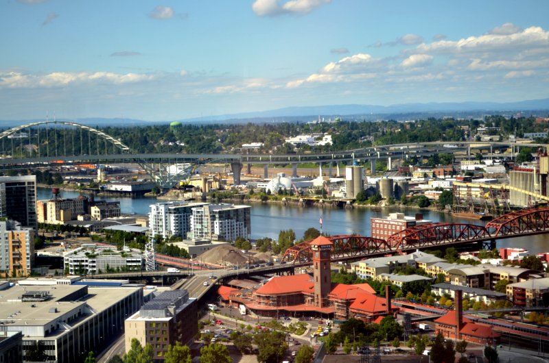
Looking northeast across the Willamette River. The rust-colored bridge is the Broadway Bridge. The sweeping arched bridge is the Fremont Bridge. And in the foreground is the magnificent Union Station which is undergoing some sort of work on its exterior. I altered the photo in Picnik with the exposure and the sharpness tools.

DSC_0104p_HDRish_frame_800
Looking more north than east across the Pearl in the forefront and a sort of light industrial area that brackets the train tracks as the head north out of downtown Portland, not far from the river. See there in the distance where the hills meet the river? Two dark, upright shapes? Just to the left of the leftmost one, there's a dimmer upright shape. And between the two dark, upright shapes there is a dim shape that goes from the dimmer upright shape on to in between the two dark, upright shapes and parallel with the surface of the river. OK. The two dark, upright shapes are part of the Burlington Northern Railroad Bridge, a truss bridge with a vertical lift. The dimmer upright shape and the dim shape parallel with the river are part of the St. Johns Bridge, a photo of which is included in my September 19 post. When I rode the SP 4449 on July 3, we crossed the Willamette River using that railroad bridge. Milton and Kay crossed it as they entered Portland. I altered this photo with the HDR-ish effect and put a frame around it.

DSC_0112p_exposure_sharpen
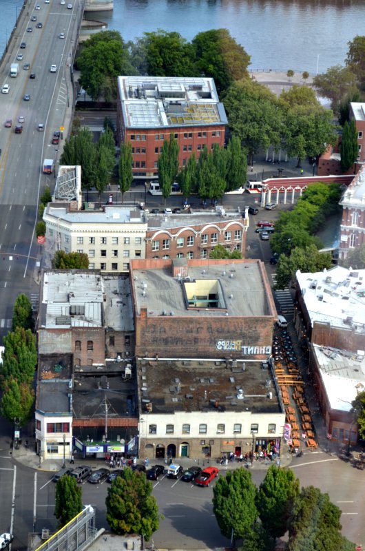
Looking straight down to the east at Voodoo Doughnuts' original location on the corner of SW 3rd Avenue and SW Ankeny Street. See the tiny people in line from the red truck, along the front of the building and ending almost beneath the pink sign? Those are a few people in line for doughnuts in the middle of the afternoon--that's the hold that Voodoo has on folks, some folks anyway; to tell you the truth there are usually a whole lot more people in line. And the small, almost school-bus-colored items side-by-side in SW Ankeny are actually wooden picnic tables, while the black and white spots farther on are actually umbrellas over additional picnic tables. Portland decided in late July to make this portion of SW Ankeny car-free, a sort of patio area. The bit of a bridge that you can see on the left is the Burnside Bridge. See the MAX train in the trees, about two thirds of the way up from the bottom of the photo? It's crossing alongside the Skidmore Fountain in what's known as Ankeny Plaza. All through those trees where the three cars are parked you'll find the Portland Saturday Market which continues to the white arches topped with bricks and across the street and beneath the rest of the trees. The gray area between the trees and the river is the sort of plaza just south of the rest of the Saturday Market.

Saturday, August 27, 2011

Portland, seen from the Aerial Tram

DSC_0190p
Looking north from the Aerial Tram, the Ross Island Bridge running east and west across the bottom of the photo, the Marquam Bridge curving north and south.

DSC_0166
The Marquam Bridge--the upper deck is I-5 northbound, the lower deck is I-5 southbound.

DSC_0175
The Ross Island Bridge goes over the Willamette River between southeast and southwest Portland. At the right edge of the photo, about a third of the way up from the bottom, you can see the Aerial Tram. I'm not sure if it is coming up or going down.

DSC_0183p
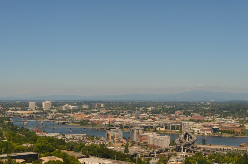
Looking pretty much northeast, you can see lots of southeast, northeast and north Portland. The bridges are, from right to left, Marquam, Hawthorne, Morrison, and Burnside.

Thursday, July 14, 2011

Candid #2

DSC_0076p-p
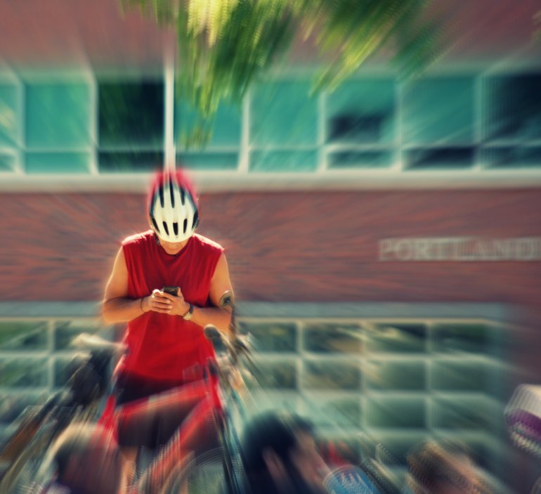
On June 25, I ventured out for the second time that sunny Saturday, riding the bus to a stop atop the Burnside Bridge. I sauntered down the steps and headed to the Saturday Market. This man's bicycle helmet caught my eye as I watched people while sitting on a low concrete wall, the Willamette River to my back. It was the Transformer-looking angle of the helmet, to be exact, and the fact that his face had practically disappeared from sight which made him even more Transformer-looking to me. As I took the photo, I couldn't help but think, "I hope he pays much, much less attention to his phone once he mounts that bicycle."

I also couldn't help myself when it came to altering the image at Picnik. Cropped, focal zoom, Orton-ish. Seems like I used an additional effect, but I cannot remember for sure. Gettin' old over here!

Friday, May 07, 2010

Portland's Urban Iditarod, seen from the Buick, Leland at the wheel

DSC_0128p
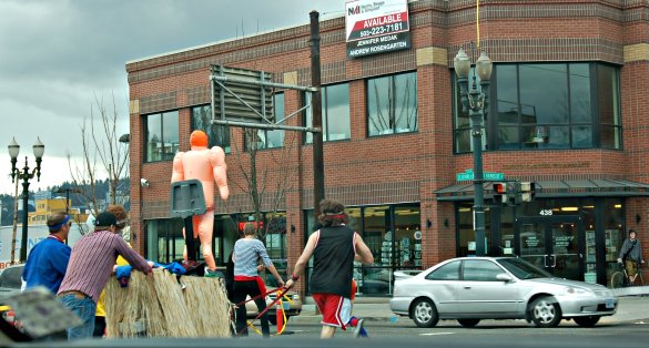
Grinning, running. Looks like fun. If you look carefully through the blur that is the windshield wiper, you can see that a couple of those guys have red straps in their hands. That means they're the dog team. I guess the guy in the purple shirt is the musher. What role does the inflatable person play? Your guess is as good as mine.

DSC_0130p
All for one, one for all, get it on down the road. We're on East Burnside, heading west towards the Burnside Bridge, eventually.

DSC_0129p
Oops! Must have hit a pothole! See the red strap in the hand of the man wearing the red shorts, The man with the red hair appears to have a strap, too.

DSC_0146p
Now they've made it six blocks--perseverance personified.

I'll post some more soon.

From the Oregonian's Web site:
Metro Portland Running »
Portland Urban Iditarod: 2010 recap
By Kelly Johnson, community blogger
March 13, 2010, 5:34PM

Hundreds of runners and probably quite a few "non-runners" showed up for the 2010 Portland Urban Iditarod. For the third year in a row, I was on a team with a group of friends that I've all met, surprisingly enough, through running.

Because the event starts under the east end of the Hawthorne Bridge, active folks that were out for an actual training run or ride stopped and asked the costumed teams what was going. "It's the Urban Iditarod," people would say, providing basically no useful information to the curious passers-by.

So, here's what it is. Take the Alaskan Iditarod, but replace the sled with a shopping cart and the dogs with runners. Add crazy costumes, turn the "aid stations" into popular bars and clubs, and a lot of people with a sense of humor.

At 11a sharp, the Lead Dog sent participants a text message reading "Grand Cafe," and the masses stampeded up the street, stopping traffic on Grand Avenue and MLK. Drivers snapped photos from their cars as they waited, and soon the party was started in a large parking lot across the street from the Grand Cafe.

Salsa dancers and karoke-ing mushers performed for the crowd as people wandered around to check out the other "sleds." Before long, another text message sent the teams to Grand Central Bowl, just a few blocks away. The next stop was the Doug Fir and Jupiter Hotel, but I made a side trip to Voodoo Doughnuts only a few blocks away at NE 14th and Sandy before rejoining the part.

Each aid station layover was about an hour long, which was a change from previous years. It was really nice to be able to wander around, catch up with friends on other teams, dance a little, order food if you wanted to, and of course, sample the variety of adult beverages. I was a little surprised to see quite a few of the participants smoking ... but then again, I saw someone smoking last year that was running the Prelay ...

Some of the best costumes that I saw included The Last Supper, The Simpsons, Gilligan and the S.S. Minnow, and a variety of underwater themes including mermaids and a man whose whole head was a shark. As usual, there were also a number that were "ripped from the headlines," including the team of UO football players wearing inmate stripes and the Greg Oden cell phone photo team.

And as usual, there were no winners and there were no losers - "just a whole lot of belligerant people," as said by KATU news a few years ago.

Monday, June 16, 2008

Up and over and down and up and around and over.

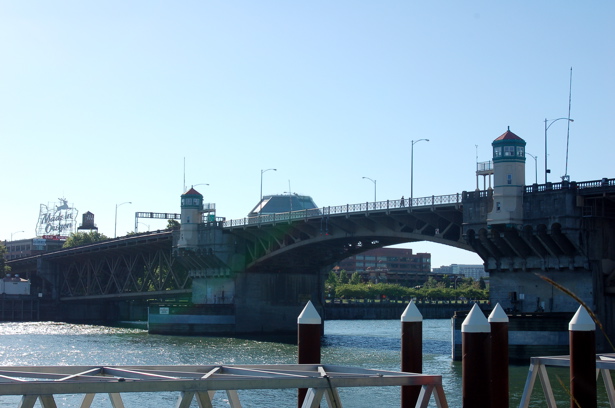
Saturday afternoon I walked up onto and across the Burnside Bridge for the first time, from west to east, left to right in the photo. I paused every so often to take photos. From this one, you know that I made it all the way over the bridge and down to the east side of the river.
burnside_bridge

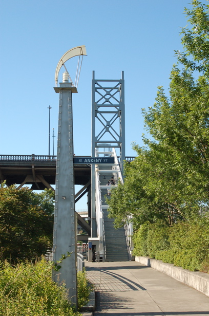
When I got to the east end of the bridge, I decided to walk down these steps. I held on tight enough to make my hand sort of dirty from running along the steel pipe handrail, but I made it to the sidewalk. I took this photo so you could see the stairs.
burnside_bridge_stairs
Here's some interesting info on the stairs that I found at the city of Portland's Web site: The historic nature of the Burnside Bridge prohibits any structure from adding any weight to the bridge: the connector that connects the Esplanade to the Burnside Bridge does not lean on the bridge, it merely 'kisses' the bridge. The connector is held in place by pilings sunk into a huge concrete base and the tower structure bears the weight of the stair truss.

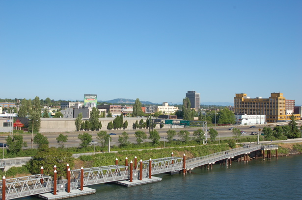
When I got to the Eastbank Esplanade, I didn't take the floating sidewalk northward. Here's a photo of that part of it, though.
eastbank_floating_sidewalk

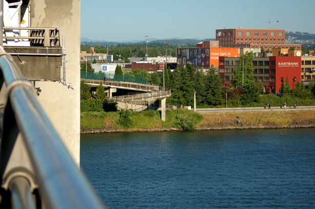
I walked from the Burnside Bridge to the pedestrian/bicycle ramp that connects to the Morrison Bridge.
morrison_bridge

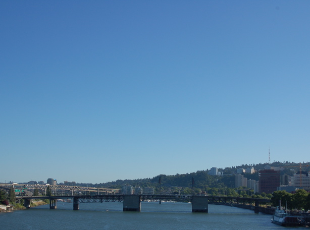
Looking at the curved ramp, I decided I could make it up and around if I stayed on the inside of the curve. Here's a photo I took from the middle of the bridge, looking eastward toward the ramp.
Morrison_ramp
I did feel short-lived moments of anxiety, but I'm actively working at overcoming my fear of bridges and heights, determined to increase my first-hand knowledge of these wonderful Willamette River bridges and the views from them.