Showing posts with label Morrison Bridge. Show all posts

Wednesday, February 13, 2013

A shared mass transit stop on SE MLK

Click here for a trip to City Daily Photo, transporting you around the world every day.

DSC_0260_crp_rz

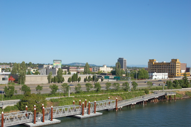
January 26 after the lecture at the Architectural Heritage Center, I decided to ride the Portland Streetcar down to the Oregon Rail Heritage Center to visit the steam locomotives. As you can see from this photo, the streetcar and the TriMet bus share this stop. That's the Morrison Bridge westbound approach you see there above the streetcar.
  DSC_0259_crp_rz

I waited while this lady boarded the bus. I think it's fantastic how that little ramp automatically folds out of the bus floor once the driver activates it. Once the bus drove off, the streetcar moved into place beside the yellow strip of ADA truncated domes which serve as a detectable safety zone, a system of textured ground surface indicators which assist blind and vision impaired pedestrians. Personally, I find them helpful, too, especially when it's been raining. I feel like they're less slick than a wet sidewalk. Anyway, the doors on the streetcar slid open and I walked on, took a seat and looked out the huge windows as we continued southward are MLK, going underneath the eastbound exit ramp of the Morrison Bridge. I love mass transit!

Tuesday, January 24, 2012

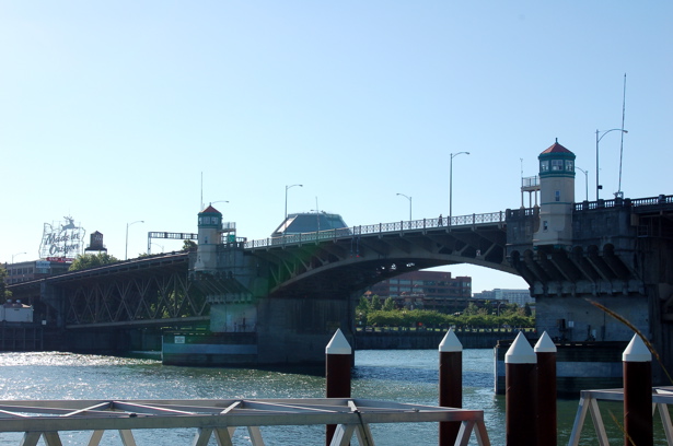
Quirky find of mine, at the east end of the Morrison Bridge

DSC_0619p
I took this photo on November 20, 2010. SPF 100, 768,000 FL OZ. I can't remember how long the water tower was painted like this, but I do remember hearing something about its decoration being illegal, according to city guidelines. I thought it matched the hideously large signs about flying to Hawaii. If I were to remove anything from this intersection, it would be those signs, not the decoration on the water tower. I altered the photo with the HDR-ish special effect at Picnik.

Wednesday, September 21, 2011

A few views of Portland from the 30th floor of the Big Pink

August 23, with Milton and Kay, I enjoyed my city from on high, through these views from the Portland City Grill in downtown.

DSC_0077p_HDRish
Looking south along SW 5th Avenue. I cropped and altered with image at Picnik with the HDR-ish effect.

DSC_0088p
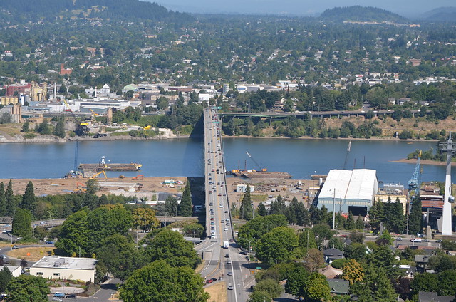
Looking southeast with the Morrison Bridge in the foreground--it's undergoing work to replace the open steel grating on the lift span. I cropped and sharpened the image a little bit at Picnik.

DSC_0089p_sharpen
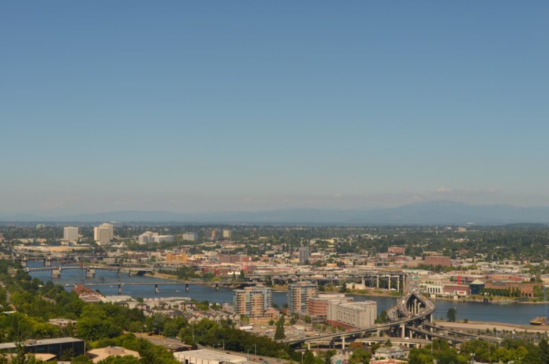
Looking mostly south down the Willamette River. The bridges, from the foreground back--the Hawthorne Bridge, the Marquam Bridge, and then the Ross Island Bridge. This photo has been cropped and sharpened at Picnik.

More views soon.

Saturday, August 27, 2011

Portland, seen from the Aerial Tram

DSC_0190p
Looking north from the Aerial Tram, the Ross Island Bridge running east and west across the bottom of the photo, the Marquam Bridge curving north and south.

DSC_0166
The Marquam Bridge--the upper deck is I-5 northbound, the lower deck is I-5 southbound.

DSC_0175
The Ross Island Bridge goes over the Willamette River between southeast and southwest Portland. At the right edge of the photo, about a third of the way up from the bottom, you can see the Aerial Tram. I'm not sure if it is coming up or going down.

DSC_0183p
Looking pretty much northeast, you can see lots of southeast, northeast and north Portland. The bridges are, from right to left, Marquam, Hawthorne, Morrison, and Burnside.

Wednesday, December 29, 2010

A deviled-egg-carrier run, on the 15 bus

DSC_0605p_p
November 20, the Saturday before Thanksgiving, after I had enjoyed a lecture at the Architectural Heritage Center, I took the 15 bus to Mall 205 to Bed, Bath and Beyond where I planned to buy a deviled egg carrier so that I would have plenty of capacity for Thanksgiving dinner at Kailey's folks. I took this photo just as the bus climbed the eastbound approach of the Morrison Bridge, right where it crosses over SW Naito Parkway. Needless to say, those vivid leaves you see there as you look south have long fallen to the street, sidewalk, and grass in Tom McCall Waterfront Park where they've turned brown. Thank goodness for the camera's ability to capture such beauty so that it can be viewed again and again.

About the Hotel Fifty that you see on the right.

DSC_0693
The deviled eggs were a big hit. The new carrier is on the right. You can see from the size of the one of the left--minus its lid so you can see the deviled eggs--that I really needed to get the new one to increase my capacity for carrying deviled eggs to get-togethers.

Here's the funny story that goes with the deviled-egg-carrier run: As the 15 bus neared the Mall 205, I asked the driver where I should get off to go to the store. "I'm looking for a deviled egg carrier," I went on, not being able to keep my mouth shut about my mission. Never missing a beat or taking his eye off the road, he said, "I know right where one is." "You do!" I exclaimed. "Right here," he quipped patting his stomach! I laughed and laughed--he joined in and then pulled to a stop so that I could get off and go on the rest my way. Later on I had to call our friends Milton and Kay--they love deviled eggs and humor. I got to laugh and laugh some more!

Thursday, June 17, 2010

In honor of blue skies, No. 4

DSC_0320p_555_thunderbird
Customized Ford Thunderbird, seen just after is crossed SE Grand on SE Morrison, on the approach for the Morrison Bridge that spans the Willamette River

Tuesday, June 01, 2010

As seen from the Hawthorne Bridge

When you live in Portland, you know you're going to go over one of the bridges, to get from east to west. You know that the Willamette River is busy. And you know that you will now and then have to wait for bridges to open and close.

We've lived here almost four years and I've only been stopped for the Hawthorne Bridge to be raised a couple of times, so I was very happy to get the chance to take these few photos on the way home from work on May 20, 2010--I was on the bus. The other times I was driving the car one time, one time it was dark, so no photos those two times.

DSC_0020
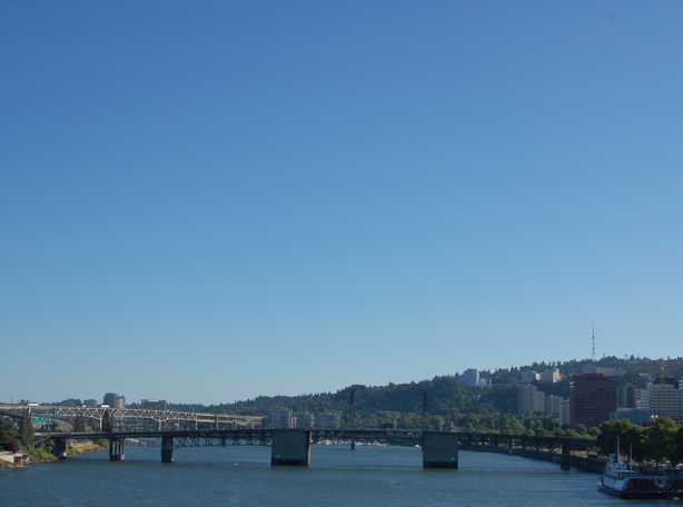
I took this photo of the Morrison Bridge through the window of the bus. We had stopped on the Hawthorne Bridge--it was being raised to let a tugboat go south on the Willamette River. I'm guessing that the tug had just pushed whatever that is in the bottom middle of the photo through the open Morrison Bridge. The black bridge in the background is the Steel Bridge.

DSC_0021
I'm looking out the windshield of the bus now. You can see the moveable part of the Hawthorne Bridge there in the middle of the photo--it's on its way back to the closed position. The pedestrians and bicyclists have stopped, the ones going west anyway.

DSC_0022
There's the tugboat, as seen through the railing on the Hawthorne Bridge.

DSC_0024
More people gather to wait. The tugboat has passed through the raised bridge, and the Hawthorne is returning to its closed position.

Monday, October 27, 2008

Light at the end of the tunnel ...

...let me explain. Besides things like family and fun thankfully taking up some of my blogging time in good ways lately, I've had some camera-to-computer downloading issues/frustrations and then additional uploading from computer to Flickr issues/frustations.

I had dealt with all of that pretty well and intended to spend a good deal of time Sunday, during the NASCAR race at Atlanta, working on a series of posts about one of several wonderful things I've been able to do in Portland recently, maybe the Dirty Dozen Brass Band at Jimmy Mak's Jazz Club or Michael Cully's Puppetry at the Oregon History Museum or Sharon Wortman's Bridge Walk involving the Morrison and Steel Bridges across the Willamette. I had a bounty of specials to choose from, as well as the unique every day things I notice all around town, until Sunday morning.

When I opened Honk, my precious little iBook, and then opened iPhoto, there was a message that read something like, "For iPhoto to run, the iLibrary needs to be updated," and I really only remember seeing OK highlighted as a choice, so I clicked on OK. In seconds all of my photos disappeared from the iPhoto Library, all 6992 of them. I sat here, stunned into silence.

To tell the truth, my calmness at this unreal turn of events totally shocked me. I didn't wail, holler, sob. I knew that I had many, many photos at Flickr already, so I accepted what had happened and then promptly downloaded my three full memory cards into Honk and started putting photos onto Flickr.

Now for the light at the end of the tunnel part of this tale. Today on the bus ride home, I talked as I often do with a young man who is a few years younger than my younger son. When I told him what had happened, he promptly said, "Why don't you use Finder and search for the jpg's?" So, I did. And I found gobs and gobs of photos. It will be some time before I know if I have found what disappeared on Sunday, but I'm some kind of hopeful! And blessed!
DSC_258

Thursday, July 03, 2008

Thursday, July 3, 2008 ... Salmon Springs Fountain, last night from the Buick

salmon_springs_ftn_night
Mama and I were on our way home from Three Doors Down Cafe, and I couldn't resist driving around the block so that she could see how the fountain looks at night. I took several photos, not expecting anything to turn out since we were stopped at the traffic signal. I do like this one, though, and want you to notice the rich blue of the sky in addition to the fountain and the people around it. All I did was download and crop, no enhancements. Just beyond the fountain is the Willamette River, and just to its right is the Hawthorne Bridge, a ways to its left is the Morrison Bridge.

Monday, June 16, 2008

Up and over and down and up and around and over.

Saturday afternoon I walked up onto and across the Burnside Bridge for the first time, from west to east, left to right in the photo. I paused every so often to take photos. From this one, you know that I made it all the way over the bridge and down to the east side of the river.
burnside_bridge

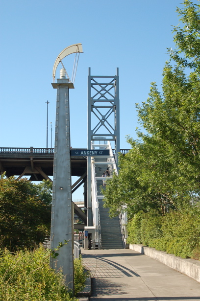
When I got to the east end of the bridge, I decided to walk down these steps. I held on tight enough to make my hand sort of dirty from running along the steel pipe handrail, but I made it to the sidewalk. I took this photo so you could see the stairs.
burnside_bridge_stairs
Here's some interesting info on the stairs that I found at the city of Portland's Web site: The historic nature of the Burnside Bridge prohibits any structure from adding any weight to the bridge: the connector that connects the Esplanade to the Burnside Bridge does not lean on the bridge, it merely 'kisses' the bridge. The connector is held in place by pilings sunk into a huge concrete base and the tower structure bears the weight of the stair truss.

When I got to the Eastbank Esplanade, I didn't take the floating sidewalk northward. Here's a photo of that part of it, though.
eastbank_floating_sidewalk

I walked from the Burnside Bridge to the pedestrian/bicycle ramp that connects to the Morrison Bridge.
morrison_bridge

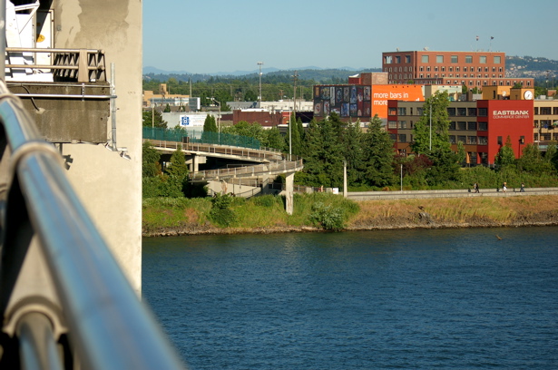
Looking at the curved ramp, I decided I could make it up and around if I stayed on the inside of the curve. Here's a photo I took from the middle of the bridge, looking eastward toward the ramp.
Morrison_ramp
I did feel short-lived moments of anxiety, but I'm actively working at overcoming my fear of bridges and heights, determined to increase my first-hand knowledge of these wonderful Willamette River bridges and the views from them.

Sunday, December 09, 2007

Random Santa Sightings

Saturday as I walked west on NW Everett, covering some ground until the bus came along to take me to the post office on NW Hoyt, I glimpsed two Santas up ahead, walking on the north sidewalk. They disappeared quickly. I couldn't catch up with them to get a photo. Hours later, after walking over the Broadway Bridge, eating lunch at Burgerville, and then walking toward the Steel Bridge, I spied three Santas crossing the street in front of me.
santas_3_enhanced

The man on your left wears sunglasses, the woman in the middle wears what appears to be red-and-white-striped tights beneath her Santa-style skirt, and the one on the right wears traditional wide, black Santa Claus belt.
santas_3_crossing_enhanced_620x542

After walking across the Steel Bridge, I sat down on a curb to get a better angle for a photo of it, and a Santa rode by on a bicycle--a lady Santa in a plaid coat. What's going on with these Santas here, there and everywhere, I wondered.
santas_1_bike

Once again, hours later as I waited at SW Washington and SW 3rd Avenue for the 15 bus, I noticed four--count them, four--Santas getting out of a parked car. (Sorry the photo's not any better.) Now I'm really curious, but it's getting late and cold, so I board the bus and head for home.
santas_4_car

To my surprise, a bus buddy--that's what I call people I've struck up an accquaintance with, mostly on the ride home--got on at SW 5th and Washington. She'd been downtown shopping at Macy's and told me all about it. As we looked out the front of the bus when it stopped at Broadway, three more Santas crossed in front of us, going north. "What's with these Santas all over today?" she asked. Shocked that she'd seen Santas, too, I explained my chance encounters to her. We couldn't come up with an answer to our mystery.

We got off the bus, wished each other "Happy Birthday"--hers is next Tuesday, mine is Wednesday--and I continued on into Walgreens to empty my memory cards onto photo CDs. I shopped while the machine worked and overheard a very tall woman talking on her cell phone while looking a reindeer headbands with little blinking Christmas lights. Evidently she was about to join friends who had been in a pub crawl since noon, and she wanted to wear something funny and/or entertaining. I tucked that bit of information away in my mind.

Once I got home, I downloaded photos, put those other Morrison Bridge photos on the blog, then started reading comments on my blog and looking at those blogs. I came across a new one, Nicole, at The Path of a Modern Goddess. In exploring her posts, I discovered that she and her husband had met at a Santa Claus pub crawl--the light bulb atop my head came on!

Could that be the explanation? I couldn't find anything on a quick search of Google, so I stopped thinking about the Santas until tonight when I started working on my blog. I typed in more specific info on Google, and I found out that there indeed had been a Santa event of sorts in Portland yesterday, beginning at noon, complete with a set of instructions and a map. You can read about it here, but be forewarned, it is NOT meant to be a warm and fuzzy holiday event.

Still and all, I'm glad to have an explanation for those random Santa sightings. And I'm planning to be at this year's tuba concert--Tuba Christmas--weather permitting, at Pioneer Courthouse Square on Dec. 15; maybe I'll see a second wave of Santas.

Sunday, September 30, 2007

Mama and I recently visited Portland's Lone Fir Cemetery

100107_wide_view_635x476

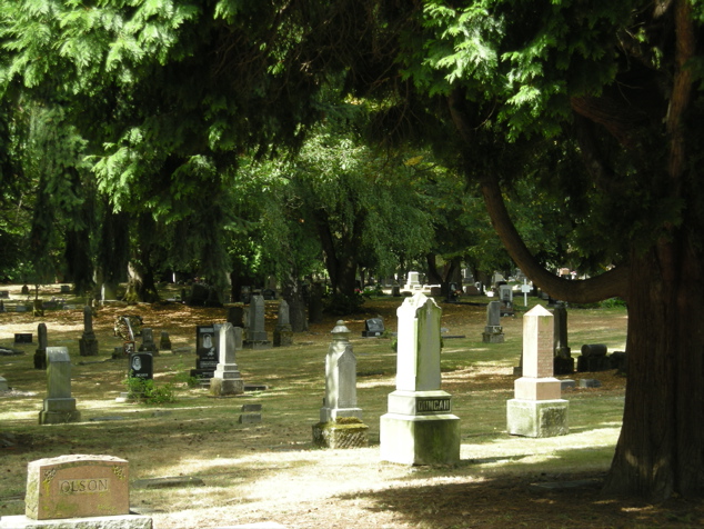
The City Daily Photo Blog where I have my other blog, Portland (OR) Daily Photo, has a monthly theme for the first day of each month. That gives bloggers an interesting challenge. October’s theme is cemeteries and tombstone, so I knew I needed to find an interesting cemetery. A friend at work suggested Lone Fir Cemetery in Southeast Portland; I got online and discovered several lists of interesting tombstones and burials, some notated with the lot and block so that one could possibly locate the site, as well as a maps of the entire cemetery and its blocks.

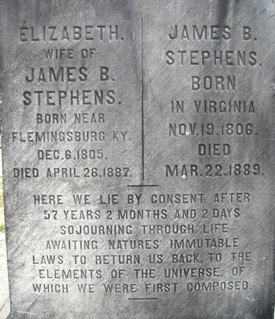
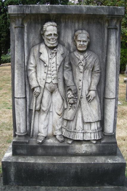
Right away I knew I wanted to find Lot 18, Block 1. So on Saturday morning a week ago, Mama, Duncan and I walked the five blocks to the car, printed information in hand. We headed across the Willamette on Morrison Bridge. Once I located the entrance to Lone Fir, I drove slowly into the beautiful, tree-filled cemetery, heading for what I felt would be the correct corner to find the burial site of James B. Stephens and his wife Elizabeth. As the car approached a 90-degree right turn, I stopped and looked over my left shoulder.

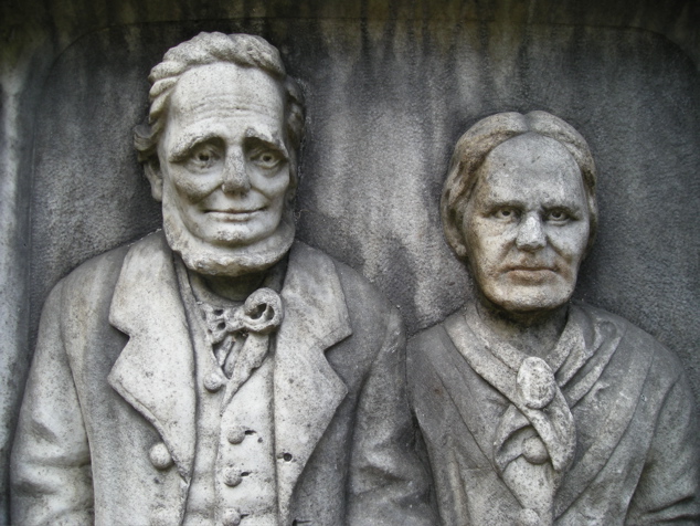
“Hot diggedty dog! There it is!” I hollered. I put the car in park, lowered the windows a bit, turned off the engine, and left Mama and Duncan to enjoy the view. You can understand why I wanted to find this toomstone, can't you? As I stood there before them, I got the distinct impression they were glad that I'd come to visit. Their eyes seemed to real to me; it was a great experience.
100107_couple_darker_635x476

According to the Friends of Lone Fir Cemetery: "James B. Stephens came to Oregon in 1844 and operated the historic Stark Street ferry on the Willamette River in Portland. James and Elizabeth Stephens were married more than 57 years when she died in 1887. The grieving widower is said to have had the couple's photograph taken a few years before her death. Until his death two years later, James was able to visit here and imagine again holding the hand of his dear wife."
100107_couple_full_length_427x639

100107_couple_wide_altered_426x639

100107_couple_words_548x635

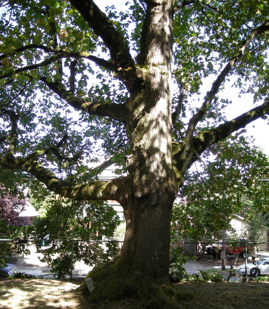
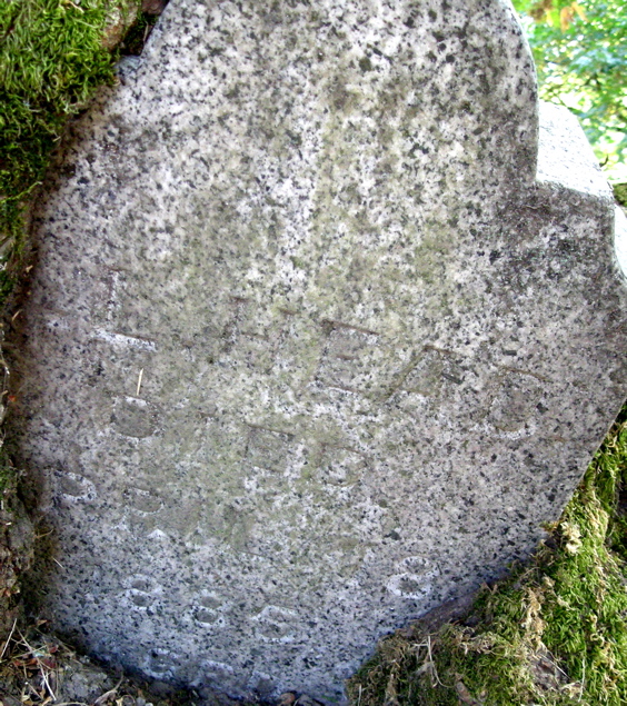
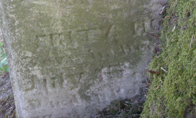
Naturally I took loads of photos elsewhere in the cemetery, too. Just around the right turn, there stood this big tree that had eaten a headstone!
100107_tree_ate_stones_555x635

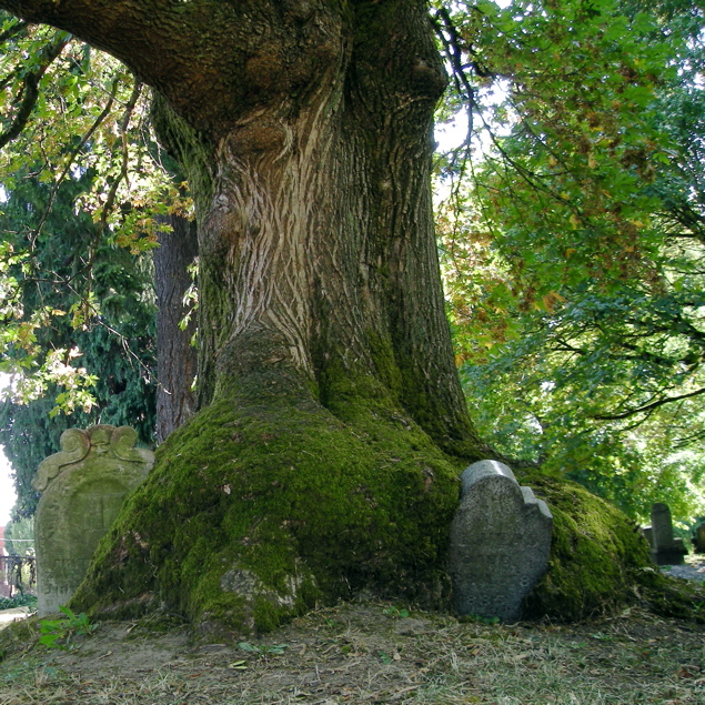
Once I got out to take a photo, I saw that the tree had actually eaten two!
100107-tree_tstones_altered_635x635

Here you see close-up shots of the the two tombstones. I can't make out much on either one, maybe 1885 on the one from the right side of the tree, maybe Fritz and July from the other one. Can you make out anything? If you have some sort of photo-enhancement-capabilites and want to play with the images, e-mail me and I'll send you the originals, uncropped, etc.
100107_right_stone_close_565x635

100107_left_stone_635x382

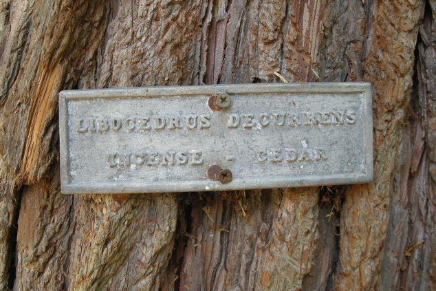
Directly opposite this tree and its tombstones, there stands a cedar with a little sign attached to it. Since it says incense cedar, I leaned in, near the bark, for a sniff. I couldn't smell anything that I'd call incense--just an outdoors sort of scent.
100107_cedar_tree_sign_635x423

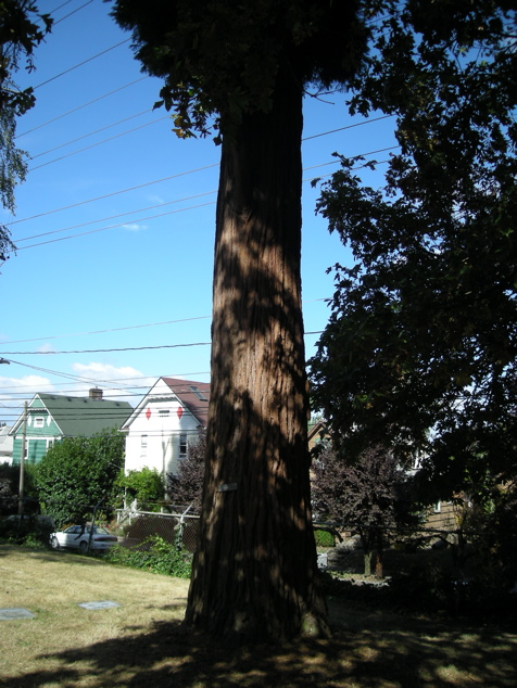
This photo doesn't really show you how big around or tall the tree is, but you can see the houses across the street from this edge of the cemetery. I believe we're looking northwest.
100107_cedar_tree_476x635

Buried in the ground between the two trees, I noticed this lovely small tombstone.
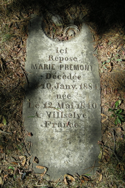
100107_french_grave_426x639

I also found quite a few interesting Woodmen of the World monuments. The way this one has settled over the years has led to erosion of the dates of birth and death for Aksel Johnson.
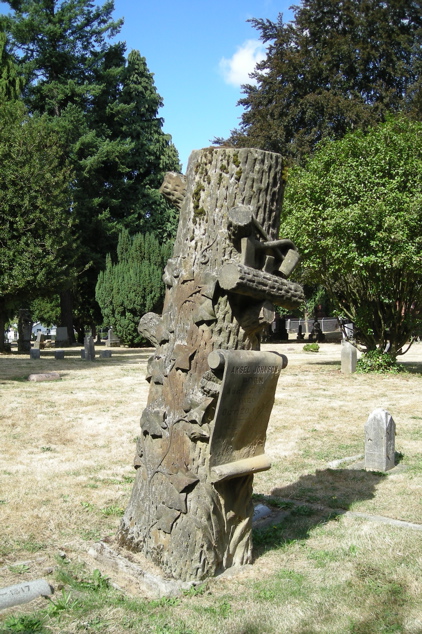
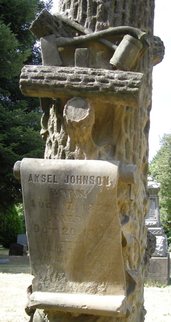
100107_wmw1_423x635

100107_wmw1_altered_338x635

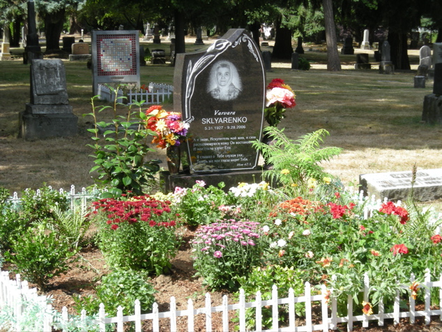
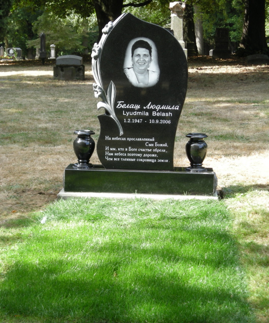
I found some interesting modern monuments, too. This first one has beautiful green grass which the family must have put down and keeps watered. It must be one of the ones mentioned by Anna Griffin in an April, 2005, Oregonian article: Within the cemetery's 30 acres, the weathered gray obelisks of Portland's founding fathers rest alongside the black-as-night granite memorials of more recent arrivals from Eastern Europe, their tombstones decorated with laser-etched pictures of the deceased and epitaphs written in Cyrillic letters.
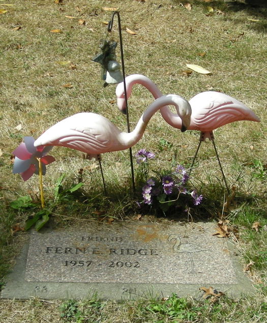
100107-2006_stone_green_grass_531x635

100107_flamingo_grave_525x635

100107_2006_stone_flowers_fence_635x476

I saved another unique tombstone for the last.
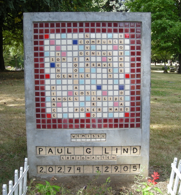
100107_scrabble_stone_588x635

Finally, here you have several articles about Lone Fir Cemetery. They are not all exactly alike. I think the county's leaves out some important recent developments.

From Wikipedia, the free encyclopedia

Lone Fir Cemetery in the southeast section of Portland, Oregon, United States is a cemetery owned and maintained by Metro, a regional government entity. Listed on the National Register of Historic Places, the first burial was in 1846 with the cemetery established in 1855. Lone Fir has over 25,000 burials over 30+ acres.

History

Lone Fir’s first burial came in 1846 when Emmor Stephens was buried several miles east of the small community of Portland. In 1854 Emmor’s son J. B. Stephens sold the family farm to Colburn Barrell with the caveat that Barrell maintain the gravesite. The following year Barrell’s steamboat the Gazelle, exploded near Oregon City killing a passenger and Barrell’s business partner Crawford Dobbins.[1] Barrel then set up a cemetery by setting aside 10 acres and burying the casualties of the explosion at the site of Emmor Stephens, calling it Mt. Crawford. Plots at the cemetery were then sold for $10 with 20 additional acres being added to Lone Fir by 1866. That year Barrel offered to sell the cemetery to the city of Portland for $4,000, but the city declined and instead Barrel sold it to a group of investors. Those investors then re-named the cemetery to Lone Fir as there was only a single fir tree at the site.

In 1903, a $3,500 memorial to the soldiers of the Indian Wars, Mexican-American War, the American Civil War, and the Spanish-American War was built at the cemetery. The Soldier’s Monument was paid for by donations by over 500 citizens. Then in 1928 Multnomah County took over control and maintenance of Lone Fir. In 1947 the county paved part of the cemetery and later constructed a building on the site. This was the location of many Chinese graves, which were removed the next year. In 2004 it was discovered that more graves likely remained at the site. In 2005 city leaders proposed removing the government building that was constructed over the graves of these Chinese immigrants and re-connecting that portion with the main cemetery. In January of 2007 Metro took over control of this section of the cemetery after a transfer from the county. On August 16, 2007, the cemetery was added to the National Register of Historic Places.

Currently the cemetery is located between Stark Street on the north and Morrison Street to the south, with Southeast 20th Avenue bounding on the west and Southeast 26th on the east. Lone Fir covers 30.5 acres and has over 25,000 graves, with over 10,000 of those unknown due to poor maintenance. It is home to the Pioneer Rose Garden.

Lone Fir’s first burial came in 1846 when Emmor Stephens was buried several miles east of the small community of Portland. In 1854 Emmor’s son J. B. Stephens sold the family farm to Colburn Barrell with the caveat that Barrell maintain the gravesite. The following year Barrell’s steamboat the Gazelle, exploded near Oregon City killing a passenger and Barrell’s business partner Crawford Dobbins. Barrel then set up a cemetery by setting aside 10 acres and burying the casualties of the explosion at the site of Emmor Stephens, calling it Mt. Crawford. Plots at the cemetery were then sold for $10 with 20 additional acres being added to Lone Fir by 1866. That year Barrel offered to sell the cemetery to the city of Portland for $4,000, but the city declined and instead Barrel sold it to a group of investors. Those investors then re-named the cemetery to Lone Fir as there was only a single fir tree at the site.

In 1903, a $3,500 memorial to the soldiers of the Indian Wars, Mexican-American War, the American Civil War, and the Spanish-American War was built at the cemetery. The Soldier’s Monument was paid for by donations by over 500 citizens. Then in 1928 Multnomah County took over control and maintenance of Lone Fir. In 1947 the county paved part of the cemetery and later constructed a building on the site. This was the location of many Chinese graves, which were removed the next year. In 2004 it was discovered that more graves likely remained at the site. In 2005 city leaders proposed removing the government building that was constructed over the graves of these Chinese immigrants and re-connecting that portion with the main cemetery. In January of 2007 Metro took over control of this section of the cemetery after a transfer from the county. On August 16, 2007, the cemetery was added to the National Register of Historic Places.

Currently the cemetery is located between Stark Street on the north and Morrison Street to the south, with Southeast 20th Avenue bounding on the west and Southeast 26th on the east. Lone Fir covers 30.5 acres and has over 25,000 graves, with over 10,000 of those unknown due to poor maintenance. It is home to the Pioneer Rose Garden.

From Metro at http://www.metro-region.org:

Lone Fir Pioneer Cemetery -- Located between Southeast 20th and 26th avenues and Morrison and Stark streets in Portland
Founded in 1855, 30.5 acres

In 1854, J.B. Stephens sold his farm, located a few miles east of the small town of Portland, to Colburn Barrell. On the property was the grave of Stephens' father, Emmor, who died in 1846. Barrell agreed to maintain the grave site.
Colburn Barrell was a partner in a passenger steamship line between Portland and Oregon City. On April 8, 1854, the boiler of their steamship Gazelle exploded while moored near Oregon City. The accident killed several people, including Barrell's business partner, Crawford Dobbins, and a passenger. Barrell buried the victims near Stephens and set aside 10 acres as a cemetery. He named the cemetery Mt. Crawford in honor of his friend, Crawford Dobbins.

By 1866, 20 more acres were added to the original cemetery. Burial plots sold for $10. Colburn thought the cemetery should be owned by the city of Portland and offered it to the city for $4,000. The City Council turned down the offer, citing the location was too far from town. There were no bridges crossing the Willamette River, and the mule-powered Stark Street ferry was slow. Coupled with muddy roads, a funeral procession would be a weary trip at best. The cemetery was eventually sold to Portland investors in 1866 and the name changed to Lone Fir Cemetery for the solitary tree standing on the site.
Today, Lone Fir Cemetery is a wooded, landscaped arboretum in the heart of Portland. More than 25,000 people are buried here, from the familiar (Curry, Dekum, Hawthorne, Lane, Lovejoy, Macleay) to the unknown. Decay, neglect and poor record keeping in the early years have led to an estimated 10,000 unknown graves. A visit to Lone Fir Cemetery will reveal the region's rich history.

"All nations are represented, all grades of society, all states of wealth and standing. Rich lie here and poor, employer and employee, those with virtue and those without. Death has a way of banishing snobbishness, of cultivating comradeship."
—D.A. Lund, Lone Fir: Silent City of the Dead

From Multnomah County:

A Brief History of Lone Fir Cemetery
In 1854, JB Stephens sold his farm to Colburn Barrell. Within this farm was the grave of Mr. Stephen's farther Emmor Stephens who died in 1846. As part of the sale, Mr. Barrell promised to keep the grave on the property.

Colburn Barrell was a partner in a passenger steamship line running between Portland and Oregon City . On April 8, 1854 their ship, The Gazelle, exploded due to a boiler problem onboard while at a wharf in Canemah. The accident caused the death of several people including Mr. Barrell's business partner Crawford Dobbins and a passenger, David Fuller. Barrell buried both of these men on this farm near the grave of Emmor Stephens and he set aside ten acres as a cemetery, naming it Mount Crawford.

In August 1855, the county Surveyor , AB Hallock platted this area and filed it under the title of Mount Crawford Cemetery . Mr. Barrell took Lot 1 Block 1 for his family. In 1862, he donated Block 5 to the City Fire Department and sold two blocks at a low price to the Willamette and Harmony Lodges of the Masonic Order.

In 1865, thirteen acres were purchased and in 1866 seven more were added to the original cemetery. Today the total acreage of the cemetery is 30.50 acres.

Colburn Barrell felt the cemetery should be owned by the City of Portland and offered it to them for $4,000. The City Council turned it down because the cemetery was so far from the City.

When the City refused to buy the cemetery, Byron P. Cardwell, Levi Anderson, Robert Pittock and other Portland residents purchased it for $4,000 and incorporated it on July 26, 1866 . At that time Mrs. Aurelia Barrell suggested the name be changed to Lone Fir Cemetery and her suggestion was adopted.

In the fall of 1903 the Soldier's Monument was unveiled. The cost was $3,500 and the amount was contributed by more than 500 people. It was erected as a monument to soldiers of the Civil, Spanish-American, Mexican and Indian Wars.

Interest in the cemetery faded and although some lot owners and descendents of Pioneers tried to maintain it, the cemetery was run-down to a point where Multnomah County assumed control in 1928. The county restored the tract as a place of restful beauty.