
I copied and pasted this from Amir's Web site.
"I gotback Home
•29 June, 2009 • 79 Comments
I gotback home.
I am Amir…
I am FREE.
Thank you All friends around the world for your prayers, activities and helps. LOVE you ALL.
2009/6/29 – TEHRAN"
Curious to learn more? Go to Tehran 24, Daily Photos from Tehran.

Members of the City Daily Photo community take a stand with a special theme day on Sunday, June 28. From the CDP Web site: This is a special 'blog day' in order to help spread the images and stories coming out of Iran, and raise awareness of the issues that the people are protesting currently. I can connect you with everyone participating around the world. Click here to view thumbnails for all participants. You might want to click on the link every few hours because as time passes, I feel sure that more and more CDP bloggers will participate. From Paris Daily Photo, I learned that Amir, a City Daily Photo blogger from Tehran, has at the very least stopped posting as of June 17, 2009. Hilda at My Manila says this on her blog, "Freedom of expression—that was all our fellow City Daily Photo blogger from Tehran was exercising before he was arrested with hundreds of his countrymen."
For the first time ever, I have used Picnik to alter my photo of the marquee at the Arlene Schnitzer Concert Hall in order to open the post with the all encompassing question, "Where is our blogger?"
And now for the end of our walking tour. Thanks for coming along!
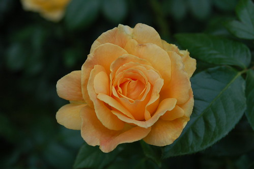
Our tour leader Peter Chausse shared interesting information with us at every stop. I just can't remember some of it, so I've found bits and pieces to give you by looking all over the Internet. And I oh so badly wanted a map to share with you for this next part, especially when I heard Peter tell us that the South Park Blocks aren't really "blocks," as in the same square footage as the rest of Portland's "blocks." They're 100 feet wide while regular blocks are 200 feet wide. So I've searched and searched for a map to put here that would give you that dynamic visual. I found it at Travel Portland Dot Com's Self-guided Tour: Portland, Oregon. However, you'll have to scroll down a ways to see it. I thought it only proper to lead off with a photo I took while on our walk. It's a single yellow rose, one of many in the gardens between the Portland Art Museum and the Oregon History Center.

Please use this link to match the numbered circles on the map with information about each one of them, available at Travel Portland Dot Com's Self-guided Tour: Portland, Oregon
From Travel Portland Dot Com: The Park Blocks (the narrow, teal green blocks on the map)
The original intention of a group of Portland pioneers was to set aside a long promenade park that would traverse the entire town site, from the Willamette River to the base of the West Hills. But their good intentions were only partly realized. The results were the 12 South Park Blocks, from Jackson to Salmon Street, and the six North Park Blocks, from Ankeny to Glisan Street.
The South Park Blocks form the center of Portland’s Cultural District. They were donated to the City in 1852 by Daniel H. Lownsdale and William W. Chapman, who both have downtown squares named for them. Around the same time, numerous lots surrounding the South Park Blocks were deeded to churches and fraternal organizations.
The South Park Blocks then were known as “The Boulevard.” Early photographs show it as a narrow clearing, cutting through the town like a flat ribbon. But in 1877 the City Council authorized the planting of 104 poplar and elm trees. By the turn of the century, homes and churches bordering the park blocks enjoyed the shade of those trees, as they still do.
As we walked southward on the slightly inclining sidewalk towards the Simon Benson House, Peter stopped and explained about the beautiful trees running parallel toward the outer edges of the South Park Blocks.
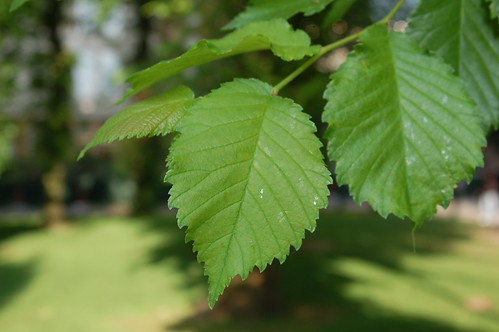
While I listened, I took this close-up shot of the elm we stood near.
Here's a photo that I took on Saturday, May 9, right after I left the Portland Streetcar and made my way towards the Portland Farmers Market that you can see in the distance.

That's Peter in the red hat, in front of the Benson House.
From Travel Portland Dot Com: You can see Simon Benson’s house several blocks north, on the Portland State University campus, facing the Park Blocks at Montgomery Street. Originally on a lot facing The Old Church, Benson’s abode was moved in early 2000 to house the offices of the PSU Alumni Association. The two-story, green, Queen Anne-style house was built in 1900 and was the Benson family home until 1912.

Here are more photos from the rose gardens.
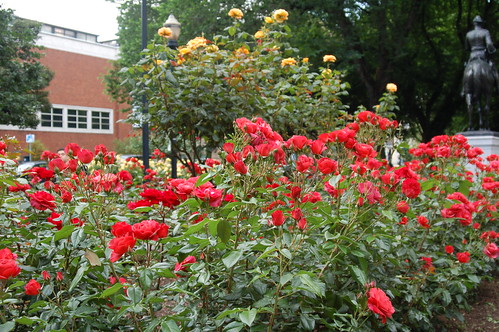
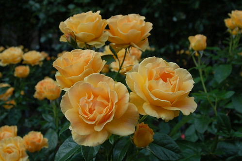
That's the Portland Art Museum in the background.
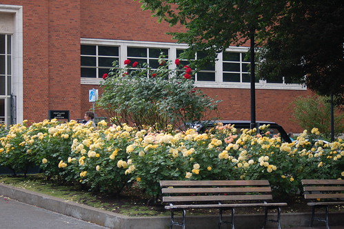
From Travel Portland Dot Com: If you go directly across the park blocks to the Portland Art Museum (map #6), pause and admire the rose and flower gardens surrounding the statue of Teddy Roosevelt, wearing a Spanish-American war uniform and riding a horse. Its title is Theodore Roosevelt Rough Rider. (My photo of this is coming up soon.)
The Portland Art Museum, built in 1933, was designed by noted Portland architect Pietro Belluschi. The brick modern-style building was renovated in 1995, in time for the blockbuster “Imperial Tombs of China” exhibit. Since then the museum has been an important stop for numerous other large exhibits. The museum has an impressive collection of its own. A new wing, opened in August 2000, houses its large Native American and Northwest art collection.
Administrative offices for the museum are next door, in what is now known as the North Wing, but originally was the Portland Masonic Temple. The monumental 1927 structure is also home to the Northwest Film Center, the museum’s rental sales gallery, the Portland Youth Philharmonic, Northwest Print Council, Oregon Ballet Theatre and Main Street Theatre. The two buildings are linked by an outdoor sculpture garden, featuring works by Barbara Hepworth and Pierre Auguste Renoir.
I took a few photos of a few sculptures back on October 18.
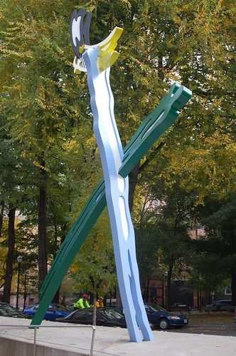
Roy Lichenstein's Brushstrokes, 1996
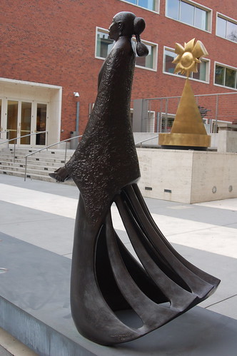
Desert Harvest, 1982, by Allan Houser

Coyote VI, 1999, by Gwynn Murrill
I took this photo last October 18. The blue and gold banners are on some of the Oregon History Center buildings.

From Portland Online: Between Jefferson and Madison stands an 18-foot-tall bronze equestrian statue of Theodore Roosevelt by New York sculptor Alexander Phimister Proctor (1860-1950), who was known for his western art. Mounted on a 14-foot tall base of California granite, the statue entitled Theodore Roosevelt - Rough Rider portrays the colonel in the actual uniform and accoutrements he wore in his famous ascent of San Juan Hill during the Spanish-American War.
It was presented to the city by Dr. Henry Waldo Coe. When Dr. Coe was just beginning his medical practice in 1884 in North Dakota, he met the young Roosevelt, who was there trying to regain his health. Their friendship lasted until Roosevelt's death in 1919. Aside from his personal friendship, Coe (who moved to Portland in 1891) admired Roosevelt's politics. It was mostly for this reason that he decided to express his admiration in the form of a public statue. Calvin Coolidge broke ground for the statue in August 1922 and it was unveiled on November 11 of that year. The block on which it stands was named Roosevelt Square.
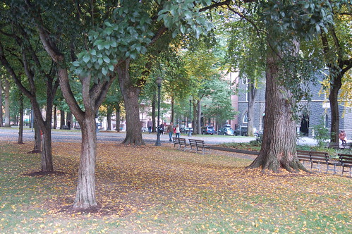
Here's another shot from October 18, the vista of the South Park Blocks in the fall. The gray basalt building on the right is the First Congregational Church, organized in 1851. From Travel Portland Dot Com: Two blocks north is First Congregational United Church of Christ (map #13) (1126 S.W. Park Ave.; 503.228.7219), at Madison Street. The stone building with the dramatic 175-foot, cream-and-red-latticed bell tower was dedicated in 1895. In Venetian Gothic style, it was modeled after Boston’s Old South Church. About the South Park Blocks, from Portland Online: In 1852 Daniel H. Lownsdale designated eleven narrow blocks of his plat at the western edge of town for public park space. Between 1852-75 the park was an unimproved roadway on the outskirts of the city center; the southern portion up to Jefferson was part of the Great Plank Road. In 1877 the first landscaping of these blocks occurred when the city council authorized florist and landscape designer Louis G. Pfunder to plant 104 Lombardy poplars and elms between Salmon and Hall Streets. Over the years, much has been added to the park, but there seems to be a consensus that the blocks should remain "a cathedral of trees with a simple floor of grass."
The bell tower at the church--I took this one while on our walk.

Oregon History Center
From Travel Portland Dot Com: Across Madison Street is the Oregon History Center (map #5). Be sure to look up when you’re at the main entrance, off a courtyard facing the South Park Blocks. The eight-story-high mural was painted in 1989 by Richard Haas on the 1923 building, originally the Sovereign Hotel. The mural’s trompe l’oeil perspective depicts members of the Lewis and Clark expedition. Another mural, on the building’s south side, illustrates the early development of Oregon. The Oregon History Center, established in 1873, has exhibits, photo archives, historical collections and a research library.
From Emporis: Companies involved in this Building* Architect: Wolff & Zimmer Associates, Zimmer Gunsul Frasca Partnership. Other companies: Pietro Belluschi, consultant during the 1967 remodeling.
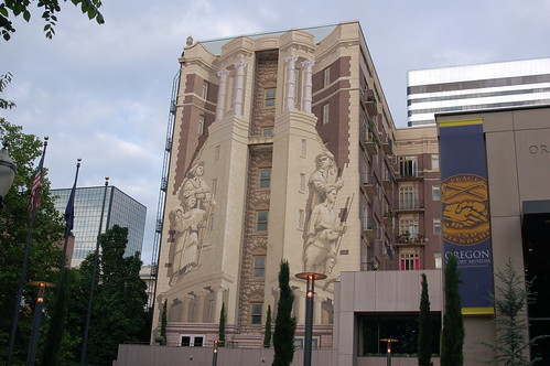
Close-up of the mural.
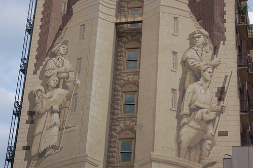
Peter led us to the exact spot to look up and see the wall and the trompe l'oeil from the side, so that we could see the actual painting, without the perspective.

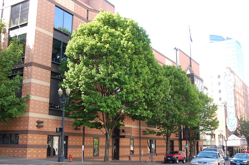
Once we left this corner, we continued north. Peter stopped on Broadway, opened his well-used copy of "Portland Then and Now (Then & Now)" by Linda Dodds, Carolyn Buan, and showed us a 1930's photo of the Portland Theatre, next to a modern photo of the same building, now known as the Arlene Schnitzer Hall. From Travel Portland Dot Com: From Pioneer Courthouse Square, walk south on Broadway, using the huge “Portland” sign as your beacon. Lit up at night with 6,000 brilliant bulbs, the sign marks the location of the Arlene Schnitzer Concert Hall (map #2), part of the Portland Center for the Performing Arts (PCPA).
In this photo, Peter's pointing to the location of the PCPA. In this photo that I took in the bright sunshine on May 14, the brick building is the PCPA. You can barely see the Portland sign at the right of the photo--such a glare that particular day.
Here's the Portland sign on a blue-sky February 28.
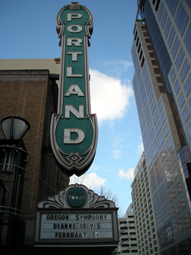
We were back at the start, finished with our walk. I had a splendid time, as did everyone. I walked a few more blocks, caught the MAX, then the 15 home.
No comments:
Post a Comment